You are here: Home > Network List > KN - Kyrgyz Seismic Telemetry Network Stations List
> Station TKM2 - > Earthquake Result Viewer
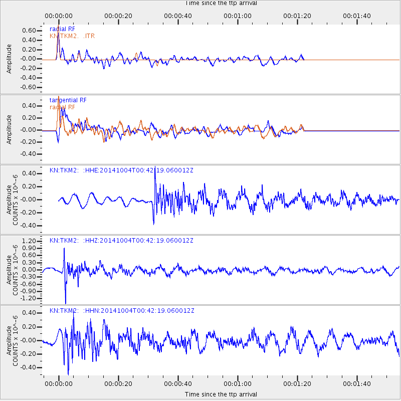
TKM2 - - Earthquake Result Viewer
*The percent match for this event was below the threshold and hence no stack was calculated.
| Earthquake location: |
Kuril Islands |
| Earthquake latitude/longitude: |
44.5/148.0 |
| Earthquake time(UTC): |
2014/10/04 (277) 00:33:59 GMT |
| Earthquake Depth: |
99 km |
| Earthquake Magnitude: |
4.9 MW |
| Earthquake Catalog/Contributor: |
ISC/ISC |
|
| Network: |
KN Kyrgyz Seismic Telemetry Network |
| Station: |
TKM2 - |
| Lat/Lon: |
42.92 N/75.60 E |
| Elevation: |
2020 m |
|
| Distance: |
50.7 deg |
| Az: |
295.25 deg |
| Baz: |
61.734 deg |
| Ray Param: |
$rayparam |
*The percent match for this event was below the threshold and hence was not used in the summary stack. |
|
| Radial Match: |
68.679955 % |
| Radial Bump: |
400 |
| Transverse Match: |
68.658775 % |
| Transverse Bump: |
400 |
| SOD ConfigId: |
3390531 |
| Insert Time: |
2019-04-14 08:27:10.456 +0000 |
| GWidth: |
2.5 |
| Max Bumps: |
400 |
| Tol: |
0.001 |
|
Signal To Noise
| Channel | StoN | STA | LTA |
| KN:TKM2: :HHZ:20141004T00:42:19.060012Z | 5.1807327 | 3.6046495E-7 | 6.9577986E-8 |
| KN:TKM2: :HHN:20141004T00:42:19.060012Z | 4.066249 | 1.744826E-7 | 4.2909964E-8 |
| KN:TKM2: :HHE:20141004T00:42:19.060012Z | 2.6654265 | 1.5378167E-7 | 5.7694958E-8 |
| Arrivals |
| Ps | |
| PpPs | |
| PsPs/PpSs | |


