You are here: Home > Network List > TA - USArray Transportable Network (new EarthScope stations) Stations List
> Station R54A Victor, WV, USA > Earthquake Result Viewer
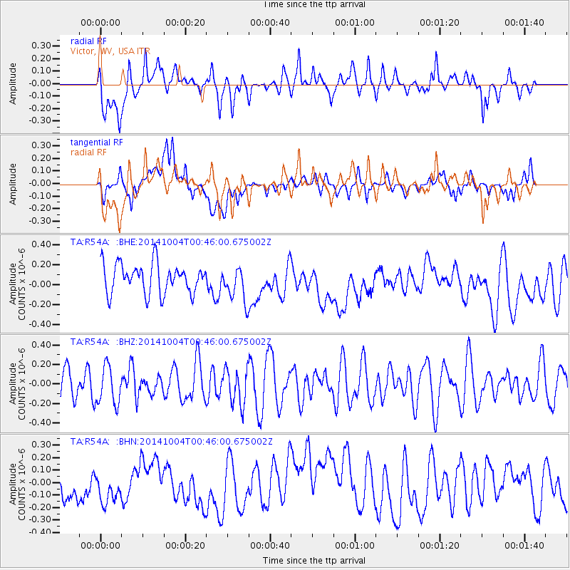
R54A Victor, WV, USA - Earthquake Result Viewer
*The percent match for this event was below the threshold and hence no stack was calculated.
| Earthquake location: |
Kuril Islands |
| Earthquake latitude/longitude: |
44.5/148.0 |
| Earthquake time(UTC): |
2014/10/04 (277) 00:33:59 GMT |
| Earthquake Depth: |
99 km |
| Earthquake Magnitude: |
4.9 MW |
| Earthquake Catalog/Contributor: |
ISC/ISC |
|
| Network: |
TA USArray Transportable Network (new EarthScope stations) |
| Station: |
R54A Victor, WV, USA |
| Lat/Lon: |
38.18 N/80.99 W |
| Elevation: |
512 m |
|
| Distance: |
86.5 deg |
| Az: |
36.572 deg |
| Baz: |
327.26 deg |
| Ray Param: |
$rayparam |
*The percent match for this event was below the threshold and hence was not used in the summary stack. |
|
| Radial Match: |
55.462406 % |
| Radial Bump: |
400 |
| Transverse Match: |
35.044125 % |
| Transverse Bump: |
400 |
| SOD ConfigId: |
3390531 |
| Insert Time: |
2019-04-14 08:30:19.437 +0000 |
| GWidth: |
2.5 |
| Max Bumps: |
400 |
| Tol: |
0.001 |
|
Signal To Noise
| Channel | StoN | STA | LTA |
| TA:R54A: :BHZ:20141004T00:46:00.675002Z | 1.0342869 | 1.9451882E-7 | 1.8807047E-7 |
| TA:R54A: :BHN:20141004T00:46:00.675002Z | 1.0113856 | 1.6200248E-7 | 1.6017876E-7 |
| TA:R54A: :BHE:20141004T00:46:00.675002Z | 1.2231803 | 1.8247302E-7 | 1.4917917E-7 |
| Arrivals |
| Ps | |
| PpPs | |
| PsPs/PpSs | |


