YKW3 - Earthquake Result Viewer
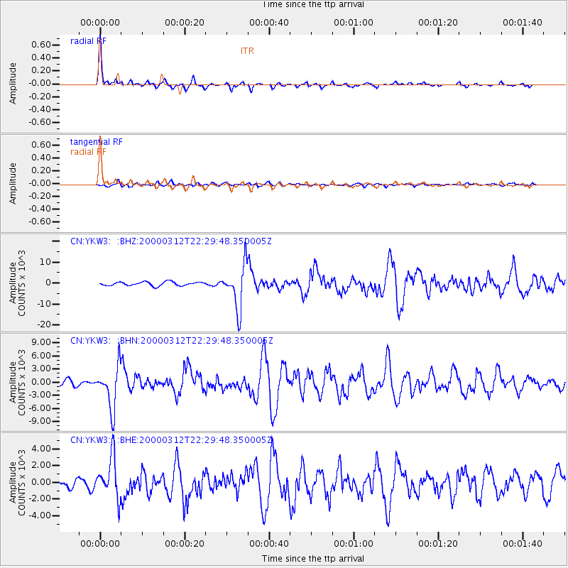
Earthquake location: Near Coast Of Chiapas, Mexico
Earthquake latitude/longitude: 15.0/-92.4
Earthquake time(UTC): 2000/03/12 (072) 22:21:30 GMT
Earthquake Depth: 62 km
Earthquake Magnitude: 5.5 MB, 5.8 MS, 6.3 MW, 5.4 MD
Earthquake Catalog/Contributor: WHDF/NEIC
Network: CN Canadian National Seismograph Network
Station: YKW3
Lat/Lon: 62.56 N/114.62 W
Elevation: 200 m
Distance: 50.0 deg
Az: 346.817 deg
Baz: 151.588 deg
Ray Param: 0.06814074
Estimated Moho Depth: 37.5 km
Estimated Crust Vp/Vs: 1.82
Assumed Crust Vp: 6.459 km/s
Estimated Crust Vs: 3.554 km/s
Estimated Crust Poisson's Ratio: 0.28
Radial Match: 94.562225 %
Radial Bump: 256
Transverse Match: 68.605 %
Transverse Bump: 400
SOD ConfigId: 3744
Insert Time: 2010-02-27 08:12:47.454 +0000
GWidth: 2.5
Max Bumps: 400
Tol: 0.001

Signal To Noise

ChannelStoNSTALTA
CN:YKW3: :BHN:20000312T22:29:48.350005Z8.763255005.8135571.2279
CN:YKW3: :BHE:20000312T22:29:48.350005Z5.51340062518.2922456.75845
CN:YKW3: :BHZ:20000312T22:29:48.350005Z11.91156610748.719902.37665
Arrivals
Ps5.0 SECOND
PpPs15 SECOND
PsPs/PpSs20 SECOND