You are here: Home > Network List > TJ - Tajikistan National Seismic Network Stations List
> Station GARM Garm, Tajikistan > Earthquake Result Viewer
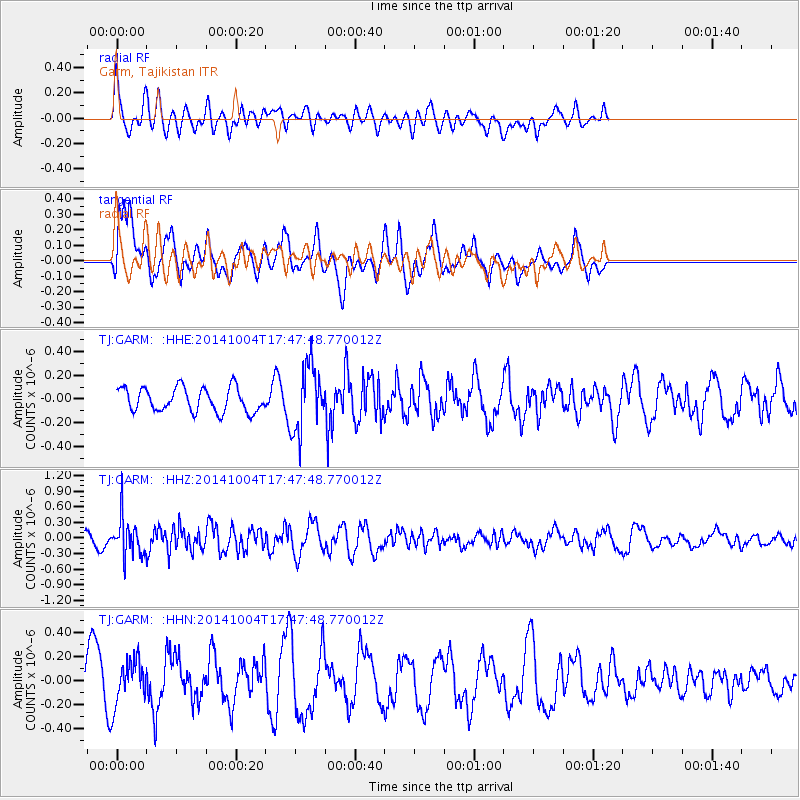
GARM Garm, Tajikistan - Earthquake Result Viewer
*The percent match for this event was below the threshold and hence no stack was calculated.
| Earthquake location: |
Philippine Islands Region |
| Earthquake latitude/longitude: |
10.9/126.0 |
| Earthquake time(UTC): |
2014/10/04 (277) 17:38:44 GMT |
| Earthquake Depth: |
80 km |
| Earthquake Magnitude: |
5.2 MW |
| Earthquake Catalog/Contributor: |
ISC/ISC |
|
| Network: |
TJ Tajikistan National Seismic Network |
| Station: |
GARM Garm, Tajikistan |
| Lat/Lon: |
39.00 N/70.32 E |
| Elevation: |
1305 m |
|
| Distance: |
56.7 deg |
| Az: |
309.612 deg |
| Baz: |
103.848 deg |
| Ray Param: |
$rayparam |
*The percent match for this event was below the threshold and hence was not used in the summary stack. |
|
| Radial Match: |
55.681293 % |
| Radial Bump: |
400 |
| Transverse Match: |
61.605648 % |
| Transverse Bump: |
400 |
| SOD ConfigId: |
3390531 |
| Insert Time: |
2019-04-14 08:38:34.619 +0000 |
| GWidth: |
2.5 |
| Max Bumps: |
400 |
| Tol: |
0.001 |
|
Signal To Noise
| Channel | StoN | STA | LTA |
| TJ:GARM: :HHZ:20141004T17:47:48.770012Z | 3.26437 | 3.5899268E-7 | 1.0997304E-7 |
| TJ:GARM: :HHN:20141004T17:47:48.770012Z | 1.2341883 | 1.9011263E-7 | 1.5403859E-7 |
| TJ:GARM: :HHE:20141004T17:47:48.770012Z | 2.7447941 | 2.7605535E-7 | 1.00574155E-7 |
| Arrivals |
| Ps | |
| PpPs | |
| PsPs/PpSs | |


