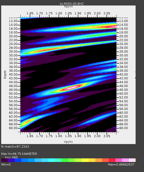
RSSD Black Hills, South Dakota, USA - Earthquake Result Viewer
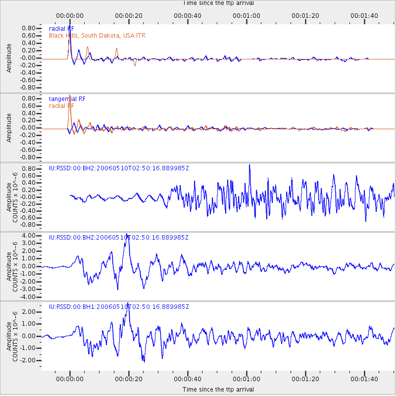
Earthquake location: Fox Islands, Aleutian Islands
Earthquake latitude/longitude: 52.5/-169.3
Earthquake time(UTC): 2006/05/10 (130) 02:42:51 GMT
Earthquake Depth: 18 km
Earthquake Magnitude: 6.1 MB, 6.2 MS, 6.4 MW, 6.3 MW
Earthquake Catalog/Contributor: WHDF/NEIC
Network: IU Global Seismograph Network (GSN - IRIS/USGS)
Station: RSSD Black Hills, South Dakota, USA
Lat/Lon: 44.12 N/104.04 W
Elevation: 2060 m
Distance: 42.8 deg
Az: 74.2 deg
Baz: 305.266 deg
Ray Param: 0.07293025
Estimated Moho Depth: 46.75 km
Estimated Crust Vp/Vs: 1.87
Assumed Crust Vp: 6.242 km/s
Estimated Crust Vs: 3.347 km/s
Estimated Crust Poisson's Ratio: 0.30
Radial Match: 97.2343 %
Radial Bump: 287
Transverse Match: 82.471695 %
Transverse Bump: 400
SOD ConfigId: 590571
Insert Time: 2013-09-25 21:16:45.355 +0000
GWidth: 2.5
Max Bumps: 400
Tol: 0.001

Signal To Noise

ChannelStoNSTALTA
IU:RSSD:00:BHZ:20060510T02:50:16.889985Z9.6892347.89049E-78.1435644E-8
IU:RSSD:00:BH1:20060510T02:50:16.889985Z6.52258255.084603E-77.795383E-8
IU:RSSD:00:BH2:20060510T02:50:16.889985Z2.45000961.344918E-75.48944E-8
Arrivals
Ps6.9 SECOND
PpPs20 SECOND
PsPs/PpSs27 SECOND