You are here: Home > Network List > TA - USArray Transportable Network (new EarthScope stations) Stations List
> Station I23K Minto, Yukon-Koyukuk, AK, USA > Earthquake Result Viewer
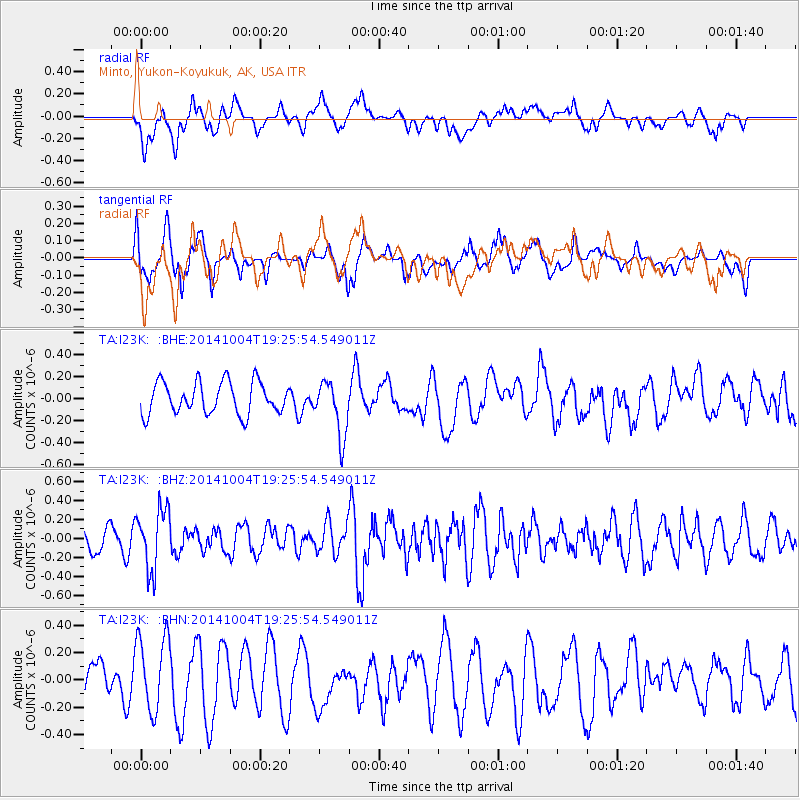
I23K Minto, Yukon-Koyukuk, AK, USA - Earthquake Result Viewer
*The percent match for this event was below the threshold and hence no stack was calculated.
| Earthquake location: |
Chiapas, Mexico |
| Earthquake latitude/longitude: |
17.4/-94.9 |
| Earthquake time(UTC): |
2014/10/04 (277) 19:16:36 GMT |
| Earthquake Depth: |
143 km |
| Earthquake Magnitude: |
5.6 MWW, 5.5 MWB, 5.7 MWC |
| Earthquake Catalog/Contributor: |
NEIC PDE/NEIC COMCAT |
|
| Network: |
TA USArray Transportable Network (new EarthScope stations) |
| Station: |
I23K Minto, Yukon-Koyukuk, AK, USA |
| Lat/Lon: |
65.15 N/149.36 W |
| Elevation: |
149 m |
|
| Distance: |
59.8 deg |
| Az: |
336.533 deg |
| Baz: |
115.878 deg |
| Ray Param: |
$rayparam |
*The percent match for this event was below the threshold and hence was not used in the summary stack. |
|
| Radial Match: |
63.005077 % |
| Radial Bump: |
400 |
| Transverse Match: |
46.98807 % |
| Transverse Bump: |
400 |
| SOD ConfigId: |
3390531 |
| Insert Time: |
2019-04-14 08:43:49.678 +0000 |
| GWidth: |
2.5 |
| Max Bumps: |
400 |
| Tol: |
0.001 |
|
Signal To Noise
| Channel | StoN | STA | LTA |
| TA:I23K: :BHZ:20141004T19:25:54.549011Z | 2.9386566 | 3.237262E-7 | 1.1016129E-7 |
| TA:I23K: :BHN:20141004T19:25:54.549011Z | 1.7621295 | 2.8132854E-7 | 1.5965259E-7 |
| TA:I23K: :BHE:20141004T19:25:54.549011Z | 1.7531992 | 2.523552E-7 | 1.4393983E-7 |
| Arrivals |
| Ps | |
| PpPs | |
| PsPs/PpSs | |


