YKW3 - Earthquake Result Viewer
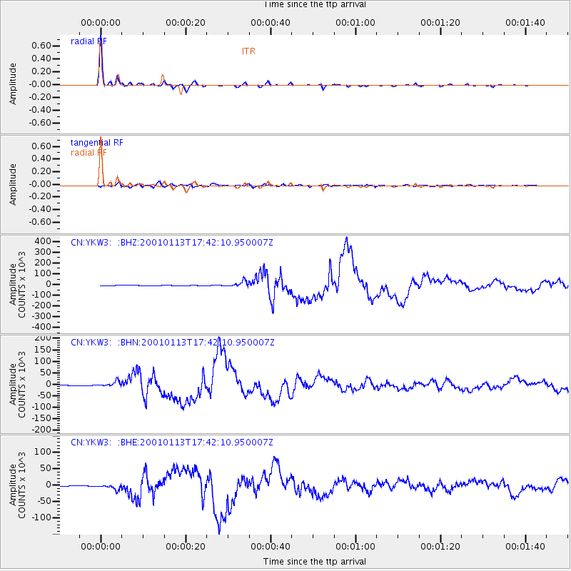
Earthquake location: El Salvador
Earthquake latitude/longitude: 13.0/-88.7
Earthquake time(UTC): 2001/01/13 (013) 17:33:32 GMT
Earthquake Depth: 60 km
Earthquake Magnitude: 6.4 MB, 7.8 MS, 7.7 MW, 7.5 ME
Earthquake Catalog/Contributor: WHDF/NEIC
Network: CN Canadian National Seismograph Network
Station: YKW3
Lat/Lon: 62.56 N/114.62 W
Elevation: 200 m
Distance: 52.8 deg
Az: 345.251 deg
Baz: 147.619 deg
Ray Param: 0.06636812
Estimated Moho Depth: 42.75 km
Estimated Crust Vp/Vs: 1.60
Assumed Crust Vp: 6.459 km/s
Estimated Crust Vs: 4.037 km/s
Estimated Crust Poisson's Ratio: 0.18
Radial Match: 99.11095 %
Radial Bump: 163
Transverse Match: 88.36597 %
Transverse Bump: 400
SOD ConfigId: 3744
Insert Time: 2010-02-27 08:14:29.309 +0000
GWidth: 2.5
Max Bumps: 400
Tol: 0.001

Signal To Noise

ChannelStoNSTALTA
CN:YKW3: :BHN:20010113T17:42:10.950007Z7.5451312612.2461671.5745
CN:YKW3: :BHE:20010113T17:42:10.950007Z4.69362458273.391762.6865
CN:YKW3: :BHZ:20010113T17:42:10.950007Z13.53197728054.6822073.2139
Arrivals
Ps4.2 SECOND
PpPs16 SECOND
PsPs/PpSs20 SECOND