YKW3 - Earthquake Result Viewer
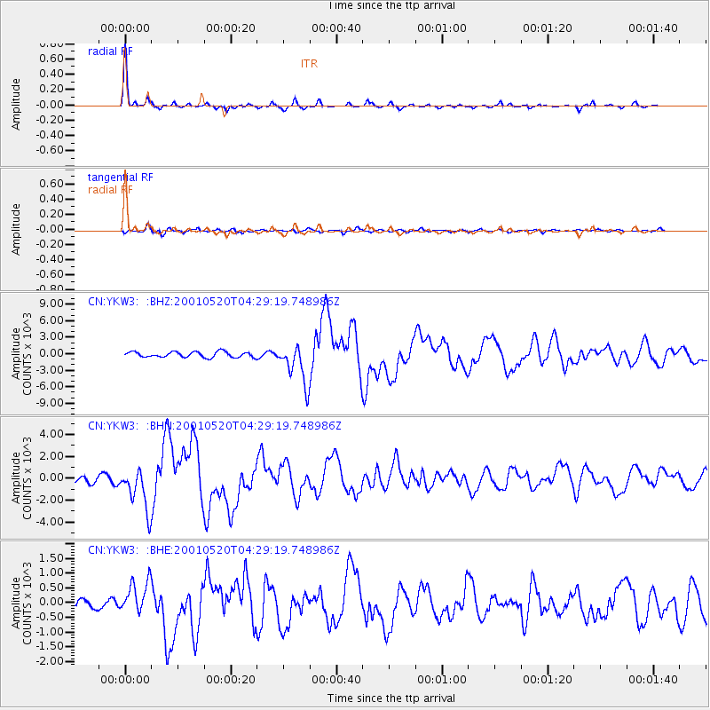
Earthquake location: Near Coast Of Jalisco, Mexico
Earthquake latitude/longitude: 18.8/-104.4
Earthquake time(UTC): 2001/05/20 (140) 04:21:43 GMT
Earthquake Depth: 33 km
Earthquake Magnitude: 5.5 MB, 6.0 MS, 6.5 MD, 6.3 MW
Earthquake Catalog/Contributor: WHDF/NEIC
Network: CN Canadian National Seismograph Network
Station: YKW3
Lat/Lon: 62.56 N/114.62 W
Elevation: 200 m
Distance: 44.3 deg
Az: 353.271 deg
Baz: 166.137 deg
Ray Param: 0.07195406
Estimated Moho Depth: 40.25 km
Estimated Crust Vp/Vs: 1.63
Assumed Crust Vp: 6.459 km/s
Estimated Crust Vs: 3.969 km/s
Estimated Crust Poisson's Ratio: 0.20
Radial Match: 93.842636 %
Radial Bump: 207
Transverse Match: 81.35515 %
Transverse Bump: 400
SOD ConfigId: 4714
Insert Time: 2010-02-27 08:14:42.201 +0000
GWidth: 2.5
Max Bumps: 400
Tol: 0.001

Signal To Noise

ChannelStoNSTALTA
CN:YKW3: :BHN:20010520T04:29:19.748986Z6.8350931945.8007284.678
CN:YKW3: :BHE:20010520T04:29:19.748986Z2.9910161560.2797187.32086
CN:YKW3: :BHZ:20010520T04:29:19.748986Z7.4179363669.2505494.64575
Arrivals
Ps4.2 SECOND
PpPs15 SECOND
PsPs/PpSs19 SECOND