You are here: Home > Network List > IU - Global Seismograph Network (GSN - IRIS/USGS) Stations List
> Station RSSD Black Hills, South Dakota, USA > Earthquake Result Viewer
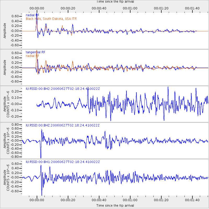
RSSD Black Hills, South Dakota, USA - Earthquake Result Viewer
*The percent match for this event was below the threshold and hence no stack was calculated.
| Earthquake location: |
Northern Chile |
| Earthquake latitude/longitude: |
-22.8/-68.7 |
| Earthquake time(UTC): |
2006/06/27 (178) 02:07:32 GMT |
| Earthquake Depth: |
115 km |
| Earthquake Magnitude: |
5.5 MW, 5.5 MW |
| Earthquake Catalog/Contributor: |
NEIC PDE/NEIC PDE-M |
|
| Network: |
IU Global Seismograph Network (GSN - IRIS/USGS) |
| Station: |
RSSD Black Hills, South Dakota, USA |
| Lat/Lon: |
44.12 N/104.04 W |
| Elevation: |
2060 m |
|
| Distance: |
74.0 deg |
| Az: |
334.319 deg |
| Baz: |
146.261 deg |
| Ray Param: |
$rayparam |
*The percent match for this event was below the threshold and hence was not used in the summary stack. |
|
| Radial Match: |
75.873764 % |
| Radial Bump: |
400 |
| Transverse Match: |
63.257442 % |
| Transverse Bump: |
400 |
| SOD ConfigId: |
590571 |
| Insert Time: |
2013-09-25 22:26:39.921 +0000 |
| GWidth: |
2.5 |
| Max Bumps: |
400 |
| Tol: |
0.001 |
|
Signal To Noise
| Channel | StoN | STA | LTA |
| IU:RSSD:00:BHZ:20060627T02:18:24.410022Z | 5.744086 | 2.68743E-7 | 4.6786038E-8 |
| IU:RSSD:00:BH1:20060627T02:18:24.410022Z | 5.4173493 | 2.520004E-7 | 4.651729E-8 |
| IU:RSSD:00:BH2:20060627T02:18:24.410022Z | 2.5391352 | 8.480056E-8 | 3.3397416E-8 |
| Arrivals |
| Ps | |
| PpPs | |
| PsPs/PpSs | |


