You are here: Home > Network List > IU - Global Seismograph Network (GSN - IRIS/USGS) Stations List
> Station RSSD Black Hills, South Dakota, USA > Earthquake Result Viewer
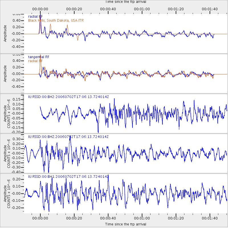
RSSD Black Hills, South Dakota, USA - Earthquake Result Viewer
*The percent match for this event was below the threshold and hence no stack was calculated.
| Earthquake location: |
Andreanof Islands, Aleutian Is. |
| Earthquake latitude/longitude: |
51.2/-179.4 |
| Earthquake time(UTC): |
2006/07/02 (183) 16:58:00 GMT |
| Earthquake Depth: |
46 km |
| Earthquake Magnitude: |
5.1 MB, 5.1 MS, 5.5 MW, 5.5 MW |
| Earthquake Catalog/Contributor: |
WHDF/NEIC |
|
| Network: |
IU Global Seismograph Network (GSN - IRIS/USGS) |
| Station: |
RSSD Black Hills, South Dakota, USA |
| Lat/Lon: |
44.12 N/104.04 W |
| Elevation: |
2060 m |
|
| Distance: |
49.2 deg |
| Az: |
67.051 deg |
| Baz: |
306.424 deg |
| Ray Param: |
$rayparam |
*The percent match for this event was below the threshold and hence was not used in the summary stack. |
|
| Radial Match: |
70.99542 % |
| Radial Bump: |
400 |
| Transverse Match: |
60.786057 % |
| Transverse Bump: |
400 |
| SOD ConfigId: |
590571 |
| Insert Time: |
2013-09-25 22:43:06.521 +0000 |
| GWidth: |
2.5 |
| Max Bumps: |
400 |
| Tol: |
0.001 |
|
Signal To Noise
| Channel | StoN | STA | LTA |
| IU:RSSD:00:BHZ:20060702T17:06:13.724014Z | 2.3648472 | 1.7939384E-7 | 7.585854E-8 |
| IU:RSSD:00:BH1:20060702T17:06:13.724014Z | 2.9972558 | 1.1410198E-7 | 3.8068816E-8 |
| IU:RSSD:00:BH2:20060702T17:06:13.724014Z | 1.4512066 | 6.211844E-8 | 4.2804682E-8 |
| Arrivals |
| Ps | |
| PpPs | |
| PsPs/PpSs | |


