You are here: Home > Network List > IU - Global Seismograph Network (GSN - IRIS/USGS) Stations List
> Station RSSD Black Hills, South Dakota, USA > Earthquake Result Viewer
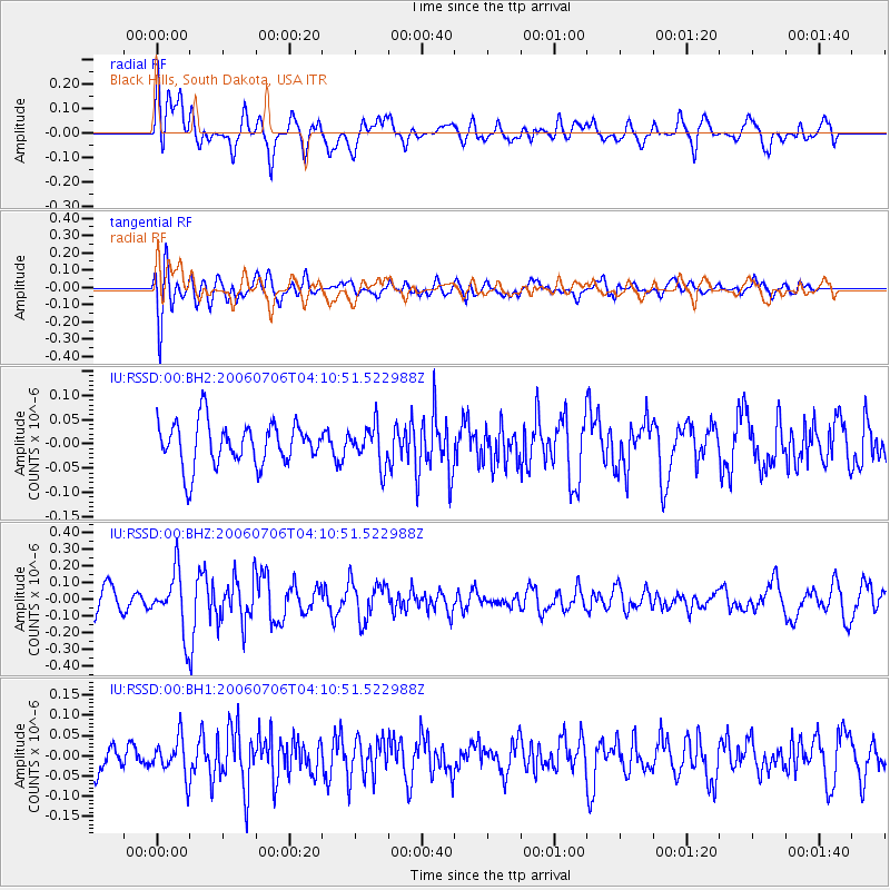
RSSD Black Hills, South Dakota, USA - Earthquake Result Viewer
*The percent match for this event was below the threshold and hence no stack was calculated.
| Earthquake location: |
Tajikistan |
| Earthquake latitude/longitude: |
39.1/71.8 |
| Earthquake time(UTC): |
2006/07/06 (187) 03:57:53 GMT |
| Earthquake Depth: |
24 km |
| Earthquake Magnitude: |
5.6 MB, 5.7 MS, 5.7 MW, 5.7 MW |
| Earthquake Catalog/Contributor: |
WHDF/NEIC |
|
| Network: |
IU Global Seismograph Network (GSN - IRIS/USGS) |
| Station: |
RSSD Black Hills, South Dakota, USA |
| Lat/Lon: |
44.12 N/104.04 W |
| Elevation: |
2060 m |
|
| Distance: |
97.0 deg |
| Az: |
356.997 deg |
| Baz: |
3.243 deg |
| Ray Param: |
$rayparam |
*The percent match for this event was below the threshold and hence was not used in the summary stack. |
|
| Radial Match: |
62.649944 % |
| Radial Bump: |
400 |
| Transverse Match: |
65.550186 % |
| Transverse Bump: |
400 |
| SOD ConfigId: |
590571 |
| Insert Time: |
2013-09-25 22:50:03.369 +0000 |
| GWidth: |
2.5 |
| Max Bumps: |
400 |
| Tol: |
0.001 |
|
Signal To Noise
| Channel | StoN | STA | LTA |
| IU:RSSD:00:BHZ:20060706T04:10:51.522988Z | 3.167473 | 1.770071E-7 | 5.5882747E-8 |
| IU:RSSD:00:BH1:20060706T04:10:51.522988Z | 1.3270189 | 4.609549E-8 | 3.473612E-8 |
| IU:RSSD:00:BH2:20060706T04:10:51.522988Z | 0.8954918 | 3.9988567E-8 | 4.4655426E-8 |
| Arrivals |
| Ps | |
| PpPs | |
| PsPs/PpSs | |


