You are here: Home > Network List > IU - Global Seismograph Network (GSN - IRIS/USGS) Stations List
> Station RSSD Black Hills, South Dakota, USA > Earthquake Result Viewer
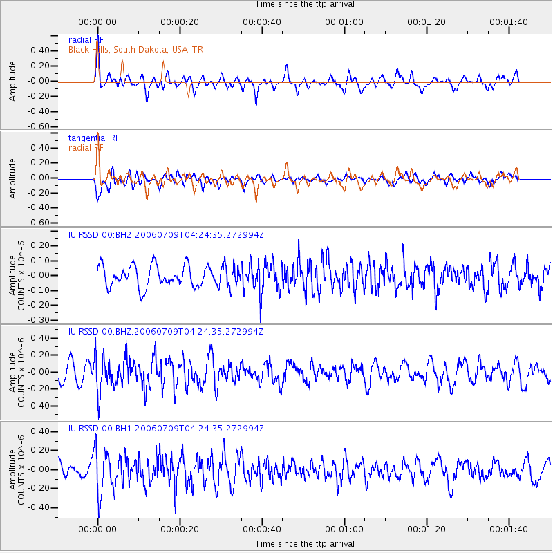
RSSD Black Hills, South Dakota, USA - Earthquake Result Viewer
*The percent match for this event was below the threshold and hence no stack was calculated.
| Earthquake location: |
Andreanof Islands, Aleutian Is. |
| Earthquake latitude/longitude: |
51.0/-179.2 |
| Earthquake time(UTC): |
2006/07/09 (190) 04:16:20 GMT |
| Earthquake Depth: |
20 km |
| Earthquake Magnitude: |
5.5 ML |
| Earthquake Catalog/Contributor: |
NEIC PDE/NEIC PDE-M |
|
| Network: |
IU Global Seismograph Network (GSN - IRIS/USGS) |
| Station: |
RSSD Black Hills, South Dakota, USA |
| Lat/Lon: |
44.12 N/104.04 W |
| Elevation: |
2060 m |
|
| Distance: |
49.1 deg |
| Az: |
67.058 deg |
| Baz: |
306.178 deg |
| Ray Param: |
$rayparam |
*The percent match for this event was below the threshold and hence was not used in the summary stack. |
|
| Radial Match: |
64.242805 % |
| Radial Bump: |
400 |
| Transverse Match: |
71.12964 % |
| Transverse Bump: |
400 |
| SOD ConfigId: |
590571 |
| Insert Time: |
2013-09-25 22:56:07.380 +0000 |
| GWidth: |
2.5 |
| Max Bumps: |
400 |
| Tol: |
0.001 |
|
Signal To Noise
| Channel | StoN | STA | LTA |
| IU:RSSD:00:BHZ:20060709T04:24:35.272994Z | 2.1201499 | 2.0734203E-7 | 9.7795926E-8 |
| IU:RSSD:00:BH1:20060709T04:24:35.272994Z | 3.827134 | 2.4021E-7 | 6.276498E-8 |
| IU:RSSD:00:BH2:20060709T04:24:35.272994Z | 0.9773534 | 7.1013154E-8 | 7.265863E-8 |
| Arrivals |
| Ps | |
| PpPs | |
| PsPs/PpSs | |


