You are here: Home > Network List > IU - Global Seismograph Network (GSN - IRIS/USGS) Stations List
> Station RSSD Black Hills, South Dakota, USA > Earthquake Result Viewer
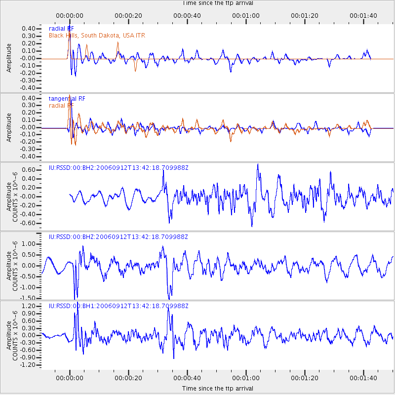
RSSD Black Hills, South Dakota, USA - Earthquake Result Viewer
*The percent match for this event was below the threshold and hence no stack was calculated.
| Earthquake location: |
La Rioja Province, Argentina |
| Earthquake latitude/longitude: |
-28.9/-68.9 |
| Earthquake time(UTC): |
2006/09/12 (255) 13:30:55 GMT |
| Earthquake Depth: |
114 km |
| Earthquake Magnitude: |
5.8 MB, 6.0 MW, 5.9 MW |
| Earthquake Catalog/Contributor: |
WHDF/NEIC |
|
| Network: |
IU Global Seismograph Network (GSN - IRIS/USGS) |
| Station: |
RSSD Black Hills, South Dakota, USA |
| Lat/Lon: |
44.12 N/104.04 W |
| Elevation: |
2060 m |
|
| Distance: |
79.5 deg |
| Az: |
335.066 deg |
| Baz: |
149.134 deg |
| Ray Param: |
$rayparam |
*The percent match for this event was below the threshold and hence was not used in the summary stack. |
|
| Radial Match: |
60.75181 % |
| Radial Bump: |
400 |
| Transverse Match: |
64.70011 % |
| Transverse Bump: |
400 |
| SOD ConfigId: |
590571 |
| Insert Time: |
2013-09-26 01:03:24.954 +0000 |
| GWidth: |
2.5 |
| Max Bumps: |
400 |
| Tol: |
0.001 |
|
Signal To Noise
| Channel | StoN | STA | LTA |
| IU:RSSD:00:BHZ:20060912T13:42:18.709988Z | 3.3519895 | 6.169702E-7 | 1.8406091E-7 |
| IU:RSSD:00:BH1:20060912T13:42:18.709988Z | 6.450176 | 4.6898475E-7 | 7.270883E-8 |
| IU:RSSD:00:BH2:20060912T13:42:18.709988Z | 2.3683414 | 2.7097067E-7 | 1.1441368E-7 |
| Arrivals |
| Ps | |
| PpPs | |
| PsPs/PpSs | |


