You are here: Home > Network List > IU - Global Seismograph Network (GSN - IRIS/USGS) Stations List
> Station RSSD Black Hills, South Dakota, USA > Earthquake Result Viewer
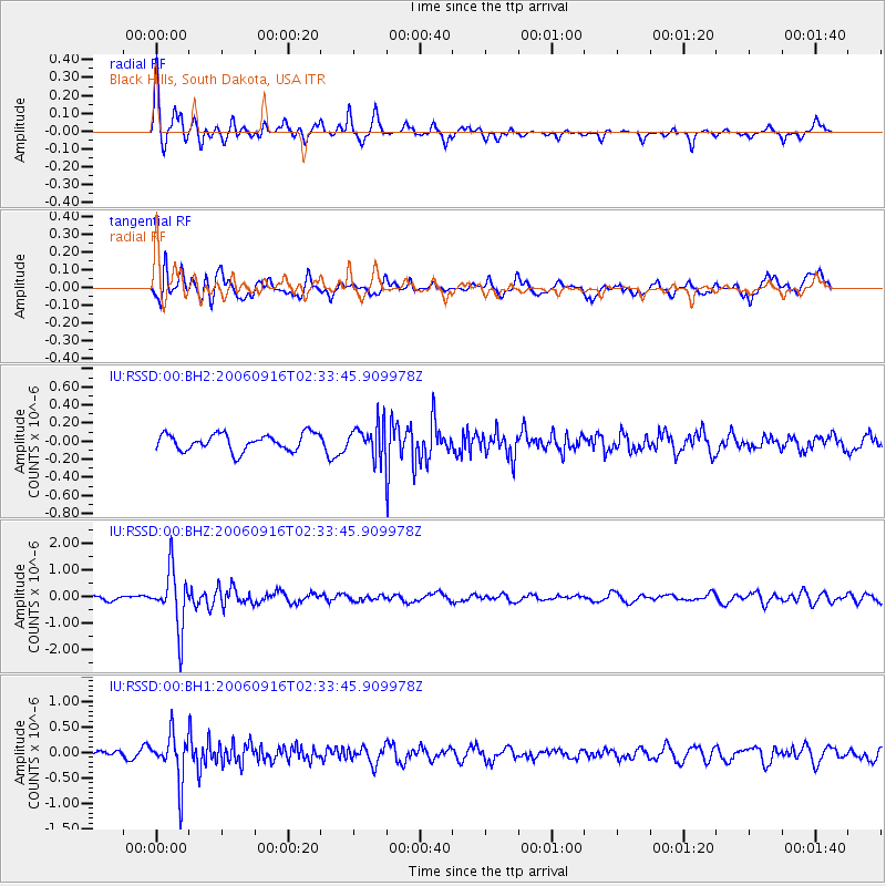
RSSD Black Hills, South Dakota, USA - Earthquake Result Viewer
*The percent match for this event was below the threshold and hence no stack was calculated.
| Earthquake location: |
Sea Of Japan |
| Earthquake latitude/longitude: |
41.4/135.7 |
| Earthquake time(UTC): |
2006/09/16 (259) 02:22:50 GMT |
| Earthquake Depth: |
367 km |
| Earthquake Magnitude: |
5.4 MB, 5.9 MW, 5.9 MW |
| Earthquake Catalog/Contributor: |
WHDF/NEIC |
|
| Network: |
IU Global Seismograph Network (GSN - IRIS/USGS) |
| Station: |
RSSD Black Hills, South Dakota, USA |
| Lat/Lon: |
44.12 N/104.04 W |
| Elevation: |
2060 m |
|
| Distance: |
79.4 deg |
| Az: |
39.256 deg |
| Baz: |
318.597 deg |
| Ray Param: |
$rayparam |
*The percent match for this event was below the threshold and hence was not used in the summary stack. |
|
| Radial Match: |
68.232315 % |
| Radial Bump: |
329 |
| Transverse Match: |
65.05073 % |
| Transverse Bump: |
400 |
| SOD ConfigId: |
590571 |
| Insert Time: |
2013-09-26 01:07:43.064 +0000 |
| GWidth: |
2.5 |
| Max Bumps: |
400 |
| Tol: |
0.001 |
|
Signal To Noise
| Channel | StoN | STA | LTA |
| IU:RSSD:00:BHZ:20060916T02:33:45.909978Z | 14.029721 | 1.0662739E-6 | 7.6001065E-8 |
| IU:RSSD:00:BH1:20060916T02:33:45.909978Z | 5.526173 | 4.6372696E-7 | 8.391467E-8 |
| IU:RSSD:00:BH2:20060916T02:33:45.909978Z | 1.8647907 | 1.7173652E-7 | 9.209426E-8 |
| Arrivals |
| Ps | |
| PpPs | |
| PsPs/PpSs | |


