YKW3 - Earthquake Result Viewer
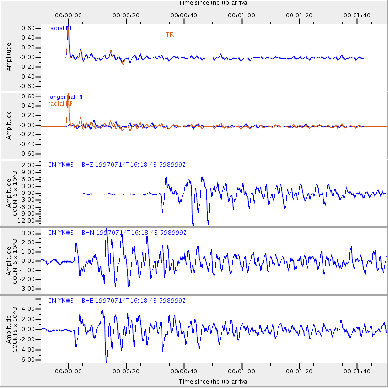
Earthquake location: Kuril Islands
Earthquake latitude/longitude: 43.2/146.4
Earthquake time(UTC): 1997/07/14 (195) 16:09:35 GMT
Earthquake Depth: 33 km
Earthquake Magnitude: 5.9 MB, 5.8 MS, 6.1 UNKNOWN, 5.8 ME
Earthquake Catalog/Contributor: WHDF/NEIC
Network: CN Canadian National Seismograph Network
Station: YKW3
Lat/Lon: 62.56 N/114.62 W
Elevation: 200 m
Distance: 56.5 deg
Az: 33.281 deg
Baz: 300.056 deg
Ray Param: 0.064049415
Estimated Moho Depth: 36.75 km
Estimated Crust Vp/Vs: 1.71
Assumed Crust Vp: 6.459 km/s
Estimated Crust Vs: 3.783 km/s
Estimated Crust Poisson's Ratio: 0.24
Radial Match: 97.3115 %
Radial Bump: 325
Transverse Match: 88.5718 %
Transverse Bump: 400
SOD ConfigId: 6273
Insert Time: 2010-02-27 08:21:50.503 +0000
GWidth: 2.5
Max Bumps: 400
Tol: 0.001

Signal To Noise

ChannelStoNSTALTA
CN:YKW3: :BHN:19970714T16:18:43.598999Z5.5232587821.1385148.6692
CN:YKW3: :BHE:19970714T16:18:43.598999Z8.9785391440.1516160.39932
CN:YKW3: :BHZ:19970714T16:18:43.598999Z24.9213733427.4993137.53252
Arrivals
Ps4.2 SECOND
PpPs15 SECOND
PsPs/PpSs19 SECOND