You are here: Home > Network List > IU - Global Seismograph Network (GSN - IRIS/USGS) Stations List
> Station RSSD Black Hills, South Dakota, USA > Earthquake Result Viewer
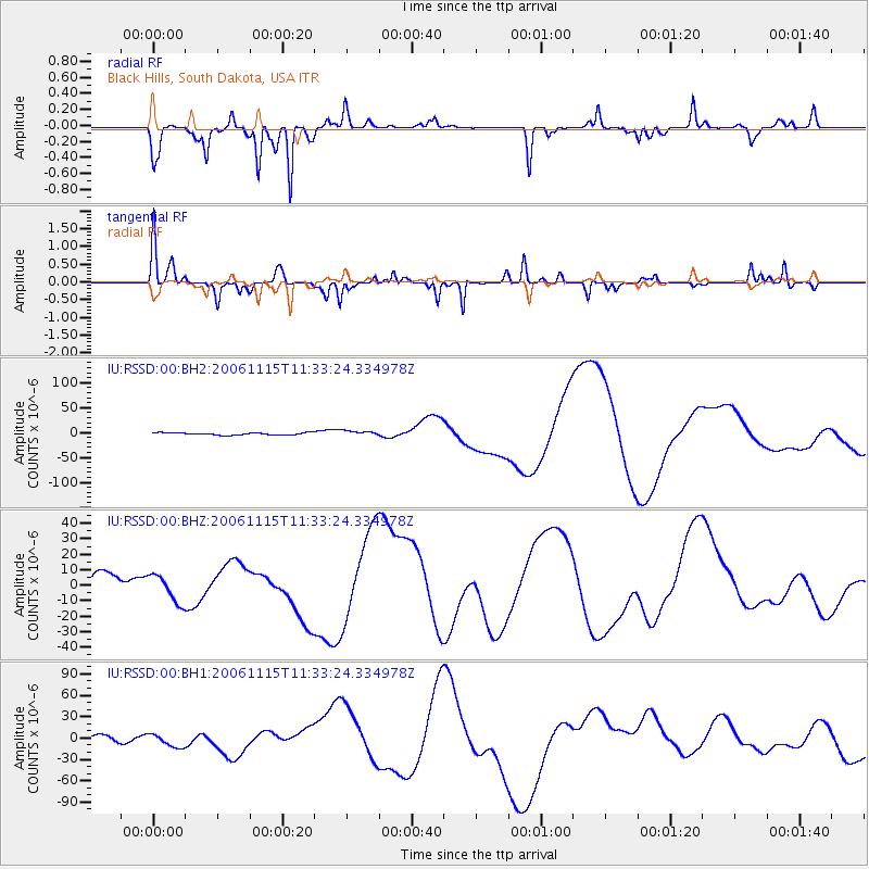
RSSD Black Hills, South Dakota, USA - Earthquake Result Viewer
*The percent match for this event was below the threshold and hence no stack was calculated.
| Earthquake location: |
East Of Kuril Islands |
| Earthquake latitude/longitude: |
46.3/154.6 |
| Earthquake time(UTC): |
2006/11/15 (319) 11:23:06 GMT |
| Earthquake Depth: |
10 km |
| Earthquake Magnitude: |
5.6 MB |
| Earthquake Catalog/Contributor: |
WHDF/NEIC |
|
| Network: |
IU Global Seismograph Network (GSN - IRIS/USGS) |
| Station: |
RSSD Black Hills, South Dakota, USA |
| Lat/Lon: |
44.12 N/104.04 W |
| Elevation: |
2060 m |
|
| Distance: |
66.3 deg |
| Az: |
50.448 deg |
| Baz: |
312.078 deg |
| Ray Param: |
$rayparam |
*The percent match for this event was below the threshold and hence was not used in the summary stack. |
|
| Radial Match: |
72.24713 % |
| Radial Bump: |
242 |
| Transverse Match: |
83.72959 % |
| Transverse Bump: |
184 |
| SOD ConfigId: |
590571 |
| Insert Time: |
2013-09-26 03:04:15.763 +0000 |
| GWidth: |
2.5 |
| Max Bumps: |
400 |
| Tol: |
0.001 |
|
Signal To Noise
| Channel | StoN | STA | LTA |
| IU:RSSD:00:BHZ:20061115T11:33:24.334978Z | 1.7693968 | 8.928124E-6 | 5.0458575E-6 |
| IU:RSSD:00:BH1:20061115T11:33:24.334978Z | 2.997686 | 9.356208E-6 | 3.1211432E-6 |
| IU:RSSD:00:BH2:20061115T11:33:24.334978Z | 2.1020002 | 4.7772537E-6 | 2.2727181E-6 |
| Arrivals |
| Ps | |
| PpPs | |
| PsPs/PpSs | |


