You are here: Home > Network List > GT - Global Telemetered Seismograph Network (USAF/USGS) Stations List
> Station CPUP Villa Florida, Paraguay > Earthquake Result Viewer
CPUP Villa Florida, Paraguay - Earthquake Result Viewer

| Earthquake location: |
Gulf Of California |
| Earthquake latitude/longitude: |
23.8/-108.4 |
| Earthquake time(UTC): |
2014/10/08 (281) 02:40:54 GMT |
| Earthquake Depth: |
10 km |
| Earthquake Magnitude: |
6.2 MWP |
| Earthquake Catalog/Contributor: |
NEIC PDE/NEIC COMCAT |
|
| Network: |
GT Global Telemetered Seismograph Network (USAF/USGS) |
| Station: |
CPUP Villa Florida, Paraguay |
| Lat/Lon: |
26.33 S/57.33 W |
| Elevation: |
105 m |
|
| Distance: |
70.2 deg |
| Az: |
132.071 deg |
| Baz: |
310.752 deg |
| Ray Param: |
0.055153813 |
| Estimated Moho Depth: |
35.75 km |
| Estimated Crust Vp/Vs: |
1.71 |
| Assumed Crust Vp: |
6.498 km/s |
| Estimated Crust Vs: |
3.794 km/s |
| Estimated Crust Poisson's Ratio: |
0.24 |
|
| Radial Match: |
84.92999 % |
| Radial Bump: |
384 |
| Transverse Match: |
66.48907 % |
| Transverse Bump: |
400 |
| SOD ConfigId: |
3390531 |
| Insert Time: |
2019-04-14 09:53:18.879 +0000 |
| GWidth: |
2.5 |
| Max Bumps: |
400 |
| Tol: |
0.001 |
|
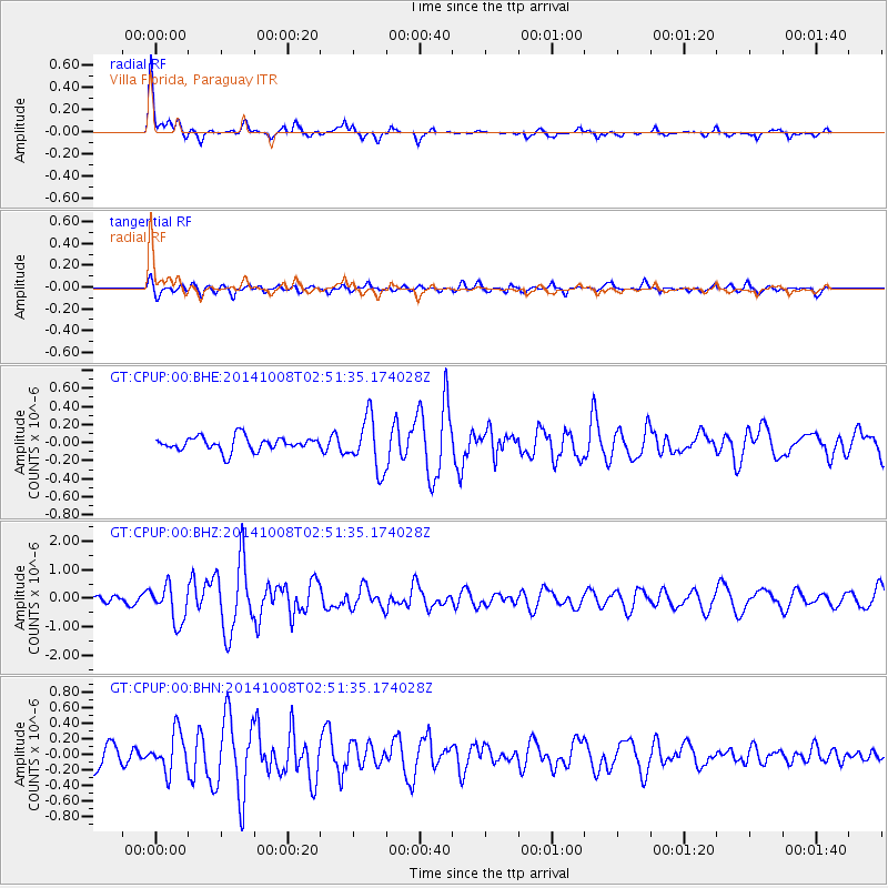
Signal To Noise
| Channel | StoN | STA | LTA |
| GT:CPUP:00:BHZ:20141008T02:51:35.174028Z | 5.0659018 | 6.421348E-7 | 1.2675626E-7 |
| GT:CPUP:00:BHN:20141008T02:51:35.174028Z | 2.0259511 | 2.5061158E-7 | 1.237007E-7 |
| GT:CPUP:00:BHE:20141008T02:51:35.174028Z | 3.7360065 | 2.9198452E-7 | 7.815418E-8 |
| Arrivals |
| Ps | 4.1 SECOND |
| PpPs | 14 SECOND |
| PsPs/PpSs | 18 SECOND |


