You are here: Home > Network List > IU - Global Seismograph Network (GSN - IRIS/USGS) Stations List
> Station RSSD Black Hills, South Dakota, USA > Earthquake Result Viewer
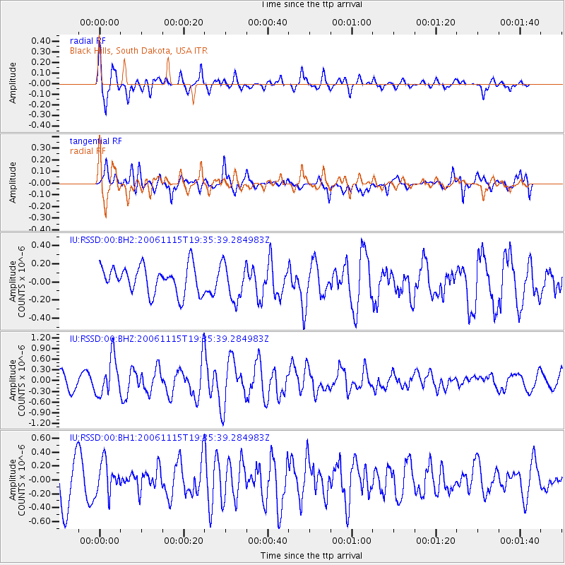
RSSD Black Hills, South Dakota, USA - Earthquake Result Viewer
*The percent match for this event was below the threshold and hence no stack was calculated.
| Earthquake location: |
Kuril Islands |
| Earthquake latitude/longitude: |
47.0/155.0 |
| Earthquake time(UTC): |
2006/11/15 (319) 19:25:25 GMT |
| Earthquake Depth: |
10 km |
| Earthquake Magnitude: |
5.6 MB, 5.6 MS |
| Earthquake Catalog/Contributor: |
WHDF/NEIC |
|
| Network: |
IU Global Seismograph Network (GSN - IRIS/USGS) |
| Station: |
RSSD Black Hills, South Dakota, USA |
| Lat/Lon: |
44.12 N/104.04 W |
| Elevation: |
2060 m |
|
| Distance: |
65.7 deg |
| Az: |
50.887 deg |
| Baz: |
312.499 deg |
| Ray Param: |
$rayparam |
*The percent match for this event was below the threshold and hence was not used in the summary stack. |
|
| Radial Match: |
69.19328 % |
| Radial Bump: |
347 |
| Transverse Match: |
60.13919 % |
| Transverse Bump: |
400 |
| SOD ConfigId: |
590571 |
| Insert Time: |
2013-09-26 03:22:44.232 +0000 |
| GWidth: |
2.5 |
| Max Bumps: |
400 |
| Tol: |
0.001 |
|
Signal To Noise
| Channel | StoN | STA | LTA |
| IU:RSSD:00:BHZ:20061115T19:35:39.284983Z | 2.222553 | 5.3394297E-7 | 2.402386E-7 |
| IU:RSSD:00:BH1:20061115T19:35:39.284983Z | 0.90506315 | 2.3143112E-7 | 2.5570716E-7 |
| IU:RSSD:00:BH2:20061115T19:35:39.284983Z | 1.3588492 | 2.0363889E-7 | 1.4986128E-7 |
| Arrivals |
| Ps | |
| PpPs | |
| PsPs/PpSs | |


