You are here: Home > Network List > X812 - Deep Structure of Three Continental Sutures in Eastern North America Stations List
> Station QM20 Hay Lake, Maine, USA > Earthquake Result Viewer
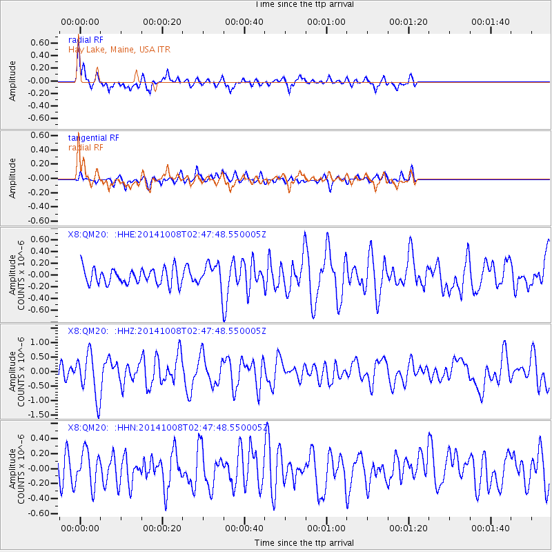
QM20 Hay Lake, Maine, USA - Earthquake Result Viewer
*The percent match for this event was below the threshold and hence no stack was calculated.
| Earthquake location: |
Gulf Of California |
| Earthquake latitude/longitude: |
23.8/-108.4 |
| Earthquake time(UTC): |
2014/10/08 (281) 02:40:54 GMT |
| Earthquake Depth: |
10 km |
| Earthquake Magnitude: |
6.2 MWP |
| Earthquake Catalog/Contributor: |
NEIC PDE/NEIC COMCAT |
|
| Network: |
X8 Deep Structure of Three Continental Sutures in Eastern North America |
| Station: |
QM20 Hay Lake, Maine, USA |
| Lat/Lon: |
46.13 N/68.72 W |
| Elevation: |
207 m |
|
| Distance: |
38.9 deg |
| Az: |
45.067 deg |
| Baz: |
248.79 deg |
| Ray Param: |
$rayparam |
*The percent match for this event was below the threshold and hence was not used in the summary stack. |
|
| Radial Match: |
76.1355 % |
| Radial Bump: |
400 |
| Transverse Match: |
63.065273 % |
| Transverse Bump: |
356 |
| SOD ConfigId: |
3390531 |
| Insert Time: |
2019-04-14 09:55:01.380 +0000 |
| GWidth: |
2.5 |
| Max Bumps: |
400 |
| Tol: |
0.001 |
|
Signal To Noise
| Channel | StoN | STA | LTA |
| X8:QM20: :HHZ:20141008T02:47:48.550005Z | 4.304896 | 7.8133456E-7 | 1.8149908E-7 |
| X8:QM20: :HHN:20141008T02:47:48.550005Z | 1.5743209 | 2.2833149E-7 | 1.450349E-7 |
| X8:QM20: :HHE:20141008T02:47:48.550005Z | 2.4538987 | 3.0894884E-7 | 1.2590121E-7 |
| Arrivals |
| Ps | |
| PpPs | |
| PsPs/PpSs | |


