You are here: Home > Network List > IU - Global Seismograph Network (GSN - IRIS/USGS) Stations List
> Station RSSD Black Hills, South Dakota, USA > Earthquake Result Viewer
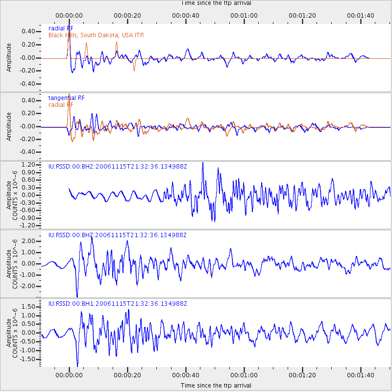
RSSD Black Hills, South Dakota, USA - Earthquake Result Viewer
*The percent match for this event was below the threshold and hence no stack was calculated.
| Earthquake location: |
Kuril Islands |
| Earthquake latitude/longitude: |
47.3/154.1 |
| Earthquake time(UTC): |
2006/11/15 (319) 21:22:21 GMT |
| Earthquake Depth: |
12 km |
| Earthquake Magnitude: |
6.0 MB, 5.8 MS, 5.9 MW, 6.1 ME |
| Earthquake Catalog/Contributor: |
WHDF/NEIC |
|
| Network: |
IU Global Seismograph Network (GSN - IRIS/USGS) |
| Station: |
RSSD Black Hills, South Dakota, USA |
| Lat/Lon: |
44.12 N/104.04 W |
| Elevation: |
2060 m |
|
| Distance: |
65.9 deg |
| Az: |
50.534 deg |
| Baz: |
313.125 deg |
| Ray Param: |
$rayparam |
*The percent match for this event was below the threshold and hence was not used in the summary stack. |
|
| Radial Match: |
69.7609 % |
| Radial Bump: |
400 |
| Transverse Match: |
67.51625 % |
| Transverse Bump: |
400 |
| SOD ConfigId: |
590571 |
| Insert Time: |
2013-09-26 03:26:28.049 +0000 |
| GWidth: |
2.5 |
| Max Bumps: |
400 |
| Tol: |
0.001 |
|
Signal To Noise
| Channel | StoN | STA | LTA |
| IU:RSSD:00:BHZ:20061115T21:32:36.134988Z | 5.2628155 | 1.155202E-6 | 2.1950265E-7 |
| IU:RSSD:00:BH1:20061115T21:32:36.134988Z | 2.8380337 | 7.024744E-7 | 2.475215E-7 |
| IU:RSSD:00:BH2:20061115T21:32:36.134988Z | 1.4145837 | 1.6384648E-7 | 1.15826644E-7 |
| Arrivals |
| Ps | |
| PpPs | |
| PsPs/PpSs | |


