You are here: Home > Network List > CN - Canadian National Seismograph Network Stations List
> Station YKW3 YKW3, NT, CANADA > Earthquake Result Viewer
YKW3 YKW3, NT, CANADA - Earthquake Result Viewer

| Earthquake location: |
Gulf Of California |
| Earthquake latitude/longitude: |
29.0/-112.9 |
| Earthquake time(UTC): |
2009/08/03 (215) 17:59:56 GMT |
| Earthquake Depth: |
10 km |
| Earthquake Magnitude: |
6.2 MB, 6.9 MW, 6.8 MW |
| Earthquake Catalog/Contributor: |
WHDF/NEIC |
|
| Network: |
CN Canadian National Seismograph Network |
| Station: |
YKW3 YKW3, NT, CANADA |
| Lat/Lon: |
62.56 N/114.61 W |
| Elevation: |
170 m |
|
| Distance: |
33.5 deg |
| Az: |
358.569 deg |
| Baz: |
177.295 deg |
| Ray Param: |
0.07815753 |
| Estimated Moho Depth: |
27.5 km |
| Estimated Crust Vp/Vs: |
1.99 |
| Assumed Crust Vp: |
6.459 km/s |
| Estimated Crust Vs: |
3.246 km/s |
| Estimated Crust Poisson's Ratio: |
0.33 |
|
| Radial Match: |
94.23729 % |
| Radial Bump: |
192 |
| Transverse Match: |
73.11781 % |
| Transverse Bump: |
400 |
| SOD ConfigId: |
2622 |
| Insert Time: |
2010-02-27 08:23:59.165 +0000 |
| GWidth: |
2.5 |
| Max Bumps: |
400 |
| Tol: |
0.001 |
|
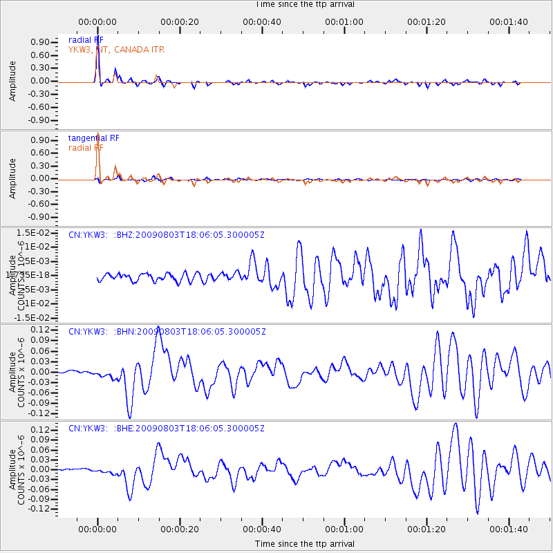
Signal To Noise
| Channel | StoN | STA | LTA |
| CN:YKW3: :BHN:20090803T18:06:05.300005Z | 3.852669 | 1.20937385E-8 | 3.1390546E-9 |
| CN:YKW3: :BHE:20090803T18:06:05.300005Z | 4.3419886 | 7.999616E-9 | 1.8423854E-9 |
| CN:YKW3: :BHZ:20090803T18:06:05.300005Z | 0.991036 | 1.2678038E-9 | 1.2792712E-9 |
| Arrivals |
| Ps | 4.5 SECOND |
| PpPs | 12 SECOND |
| PsPs/PpSs | 16 SECOND |


