You are here: Home > Network List > IU - Global Seismograph Network (GSN - IRIS/USGS) Stations List
> Station RSSD Black Hills, South Dakota, USA > Earthquake Result Viewer
RSSD Black Hills, South Dakota, USA - Earthquake Result Viewer
*The percent match for this event was below the threshold and hence no stack was calculated.
| Earthquake location: |
Kuril Islands |
| Earthquake latitude/longitude: |
46.8/153.8 |
| Earthquake time(UTC): |
2006/11/24 (328) 15:34:10 GMT |
| Earthquake Depth: |
11 km |
| Earthquake Magnitude: |
5.7 MB, 4.9 MS, 5.5 MW, 5.3 MW |
| Earthquake Catalog/Contributor: |
WHDF/NEIC |
|
| Network: |
IU Global Seismograph Network (GSN - IRIS/USGS) |
| Station: |
RSSD Black Hills, South Dakota, USA |
| Lat/Lon: |
44.12 N/104.04 W |
| Elevation: |
2060 m |
|
| Distance: |
66.5 deg |
| Az: |
50.159 deg |
| Baz: |
312.868 deg |
| Ray Param: |
$rayparam |
*The percent match for this event was below the threshold and hence was not used in the summary stack. |
|
| Radial Match: |
42.95651 % |
| Radial Bump: |
400 |
| Transverse Match: |
50.70741 % |
| Transverse Bump: |
400 |
| SOD ConfigId: |
590571 |
| Insert Time: |
2013-09-26 03:58:30.975 +0000 |
| GWidth: |
2.5 |
| Max Bumps: |
400 |
| Tol: |
0.001 |
|
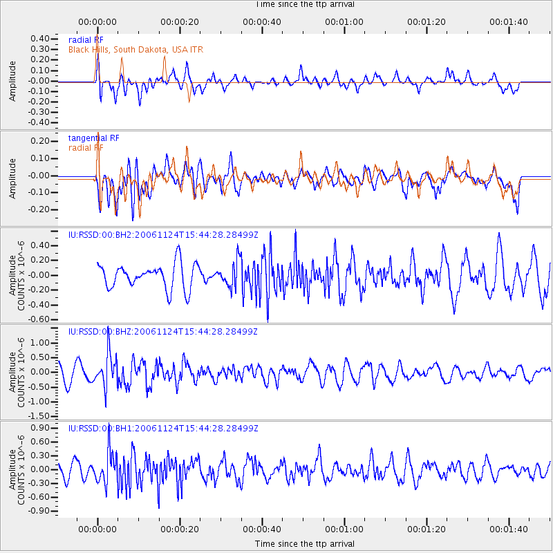
Signal To Noise
| Channel | StoN | STA | LTA |
| IU:RSSD:00:BHZ:20061124T15:44:28.28499Z | 2.9944477 | 5.7068667E-7 | 1.905816E-7 |
| IU:RSSD:00:BH1:20061124T15:44:28.28499Z | 1.8251134 | 3.51332E-7 | 1.9249872E-7 |
| IU:RSSD:00:BH2:20061124T15:44:28.28499Z | 1.0373267 | 1.737293E-7 | 1.674779E-7 |
| Arrivals |
| Ps | |
| PpPs | |
| PsPs/PpSs | |


