You are here: Home > Network List > TA - USArray Transportable Network (new EarthScope stations) Stations List
> Station I23K Minto, Yukon-Koyukuk, AK, USA > Earthquake Result Viewer
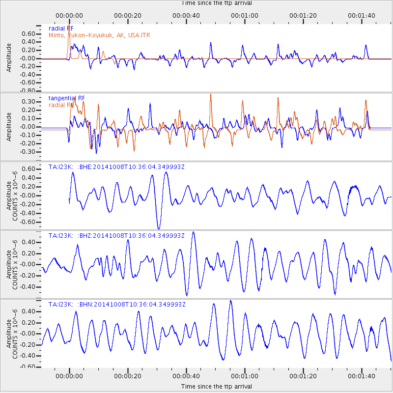
I23K Minto, Yukon-Koyukuk, AK, USA - Earthquake Result Viewer
*The percent match for this event was below the threshold and hence no stack was calculated.
| Earthquake location: |
North Of Svalbard |
| Earthquake latitude/longitude: |
80.6/-2.6 |
| Earthquake time(UTC): |
2014/10/08 (281) 10:29:57 GMT |
| Earthquake Depth: |
8.2 km |
| Earthquake Magnitude: |
5.0 MW |
| Earthquake Catalog/Contributor: |
ISC/ISC |
|
| Network: |
TA USArray Transportable Network (new EarthScope stations) |
| Station: |
I23K Minto, Yukon-Koyukuk, AK, USA |
| Lat/Lon: |
65.15 N/149.36 W |
| Elevation: |
149 m |
|
| Distance: |
33.3 deg |
| Az: |
335.019 deg |
| Baz: |
9.421 deg |
| Ray Param: |
$rayparam |
*The percent match for this event was below the threshold and hence was not used in the summary stack. |
|
| Radial Match: |
66.41824 % |
| Radial Bump: |
400 |
| Transverse Match: |
55.465435 % |
| Transverse Bump: |
400 |
| SOD ConfigId: |
3390531 |
| Insert Time: |
2019-04-14 10:12:15.634 +0000 |
| GWidth: |
2.5 |
| Max Bumps: |
400 |
| Tol: |
0.001 |
|
Signal To Noise
| Channel | StoN | STA | LTA |
| TA:I23K: :BHZ:20141008T10:36:04.349993Z | 1.2371013 | 1.6469252E-7 | 1.3312776E-7 |
| TA:I23K: :BHN:20141008T10:36:04.349993Z | 1.3608263 | 2.20615E-7 | 1.6211843E-7 |
| TA:I23K: :BHE:20141008T10:36:04.349993Z | 2.2989357 | 4.4723333E-7 | 1.9453931E-7 |
| Arrivals |
| Ps | |
| PpPs | |
| PsPs/PpSs | |


