You are here: Home > Network List > IU - Global Seismograph Network (GSN - IRIS/USGS) Stations List
> Station RSSD Black Hills, South Dakota, USA > Earthquake Result Viewer
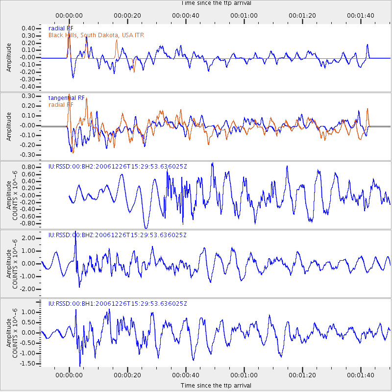
RSSD Black Hills, South Dakota, USA - Earthquake Result Viewer
*The percent match for this event was below the threshold and hence no stack was calculated.
| Earthquake location: |
Kuril Islands |
| Earthquake latitude/longitude: |
48.3/154.8 |
| Earthquake time(UTC): |
2006/12/26 (360) 15:19:45 GMT |
| Earthquake Depth: |
10 km |
| Earthquake Magnitude: |
6.0 MW, 5.7 MB, 5.8 MS |
| Earthquake Catalog/Contributor: |
NEIC PDE/NEIC PDE-M |
|
| Network: |
IU Global Seismograph Network (GSN - IRIS/USGS) |
| Station: |
RSSD Black Hills, South Dakota, USA |
| Lat/Lon: |
44.12 N/104.04 W |
| Elevation: |
2060 m |
|
| Distance: |
64.9 deg |
| Az: |
51.281 deg |
| Baz: |
313.692 deg |
| Ray Param: |
$rayparam |
*The percent match for this event was below the threshold and hence was not used in the summary stack. |
|
| Radial Match: |
59.26566 % |
| Radial Bump: |
400 |
| Transverse Match: |
54.53041 % |
| Transverse Bump: |
400 |
| SOD ConfigId: |
590571 |
| Insert Time: |
2013-09-26 05:02:56.607 +0000 |
| GWidth: |
2.5 |
| Max Bumps: |
400 |
| Tol: |
0.001 |
|
Signal To Noise
| Channel | StoN | STA | LTA |
| IU:RSSD:00:BHZ:20061226T15:29:53.636025Z | 2.197163 | 9.036442E-7 | 4.112777E-7 |
| IU:RSSD:00:BH1:20061226T15:29:53.636025Z | 1.8198048 | 5.812344E-7 | 3.1939382E-7 |
| IU:RSSD:00:BH2:20061226T15:29:53.636025Z | 1.7309794 | 3.942949E-7 | 2.2778715E-7 |
| Arrivals |
| Ps | |
| PpPs | |
| PsPs/PpSs | |


