You are here: Home > Network List > IU - Global Seismograph Network (GSN - IRIS/USGS) Stations List
> Station RSSD Black Hills, South Dakota, USA > Earthquake Result Viewer
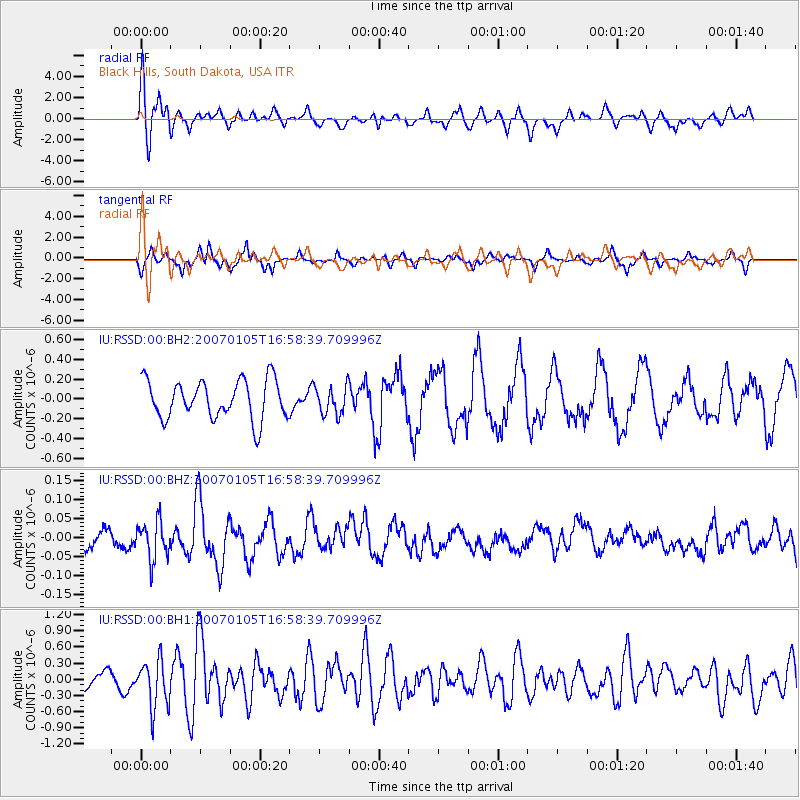
RSSD Black Hills, South Dakota, USA - Earthquake Result Viewer
*The percent match for this event was below the threshold and hence no stack was calculated.
| Earthquake location: |
South Of Alaska |
| Earthquake latitude/longitude: |
55.8/-156.1 |
| Earthquake time(UTC): |
2007/01/05 (005) 16:52:22 GMT |
| Earthquake Depth: |
19 km |
| Earthquake Magnitude: |
5.5 MS, 5.4 MB, 5.8 MW, 5.8 MW |
| Earthquake Catalog/Contributor: |
WHDF/NEIC |
|
| Network: |
IU Global Seismograph Network (GSN - IRIS/USGS) |
| Station: |
RSSD Black Hills, South Dakota, USA |
| Lat/Lon: |
44.12 N/104.04 W |
| Elevation: |
2060 m |
|
| Distance: |
34.6 deg |
| Az: |
87.313 deg |
| Baz: |
308.365 deg |
| Ray Param: |
$rayparam |
*The percent match for this event was below the threshold and hence was not used in the summary stack. |
|
| Radial Match: |
69.94132 % |
| Radial Bump: |
400 |
| Transverse Match: |
72.33968 % |
| Transverse Bump: |
292 |
| SOD ConfigId: |
590571 |
| Insert Time: |
2013-09-26 05:14:07.868 +0000 |
| GWidth: |
2.5 |
| Max Bumps: |
400 |
| Tol: |
0.001 |
|
Signal To Noise
| Channel | StoN | STA | LTA |
| IU:RSSD:00:BHZ:20070105T16:58:39.709996Z | 2.2141857 | 4.9937547E-8 | 2.2553461E-8 |
| IU:RSSD:00:BH1:20070105T16:58:39.709996Z | 3.210205 | 4.394974E-7 | 1.3690634E-7 |
| IU:RSSD:00:BH2:20070105T16:58:39.709996Z | 0.7408732 | 1.4431842E-7 | 1.9479502E-7 |
| Arrivals |
| Ps | |
| PpPs | |
| PsPs/PpSs | |


