You are here: Home > Network List > IU - Global Seismograph Network (GSN - IRIS/USGS) Stations List
> Station RSSD Black Hills, South Dakota, USA > Earthquake Result Viewer
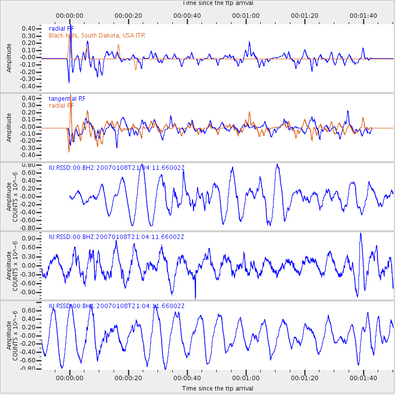
RSSD Black Hills, South Dakota, USA - Earthquake Result Viewer
*The percent match for this event was below the threshold and hence no stack was calculated.
| Earthquake location: |
Fiji Islands Region |
| Earthquake latitude/longitude: |
-18.6/-177.8 |
| Earthquake time(UTC): |
2007/01/08 (008) 20:52:20 GMT |
| Earthquake Depth: |
407 km |
| Earthquake Magnitude: |
5.6 MB, 6.3 MW, 6.3 MW |
| Earthquake Catalog/Contributor: |
WHDF/NEIC |
|
| Network: |
IU Global Seismograph Network (GSN - IRIS/USGS) |
| Station: |
RSSD Black Hills, South Dakota, USA |
| Lat/Lon: |
44.12 N/104.04 W |
| Elevation: |
2060 m |
|
| Distance: |
91.7 deg |
| Az: |
43.785 deg |
| Baz: |
245.686 deg |
| Ray Param: |
$rayparam |
*The percent match for this event was below the threshold and hence was not used in the summary stack. |
|
| Radial Match: |
57.567738 % |
| Radial Bump: |
400 |
| Transverse Match: |
59.715397 % |
| Transverse Bump: |
400 |
| SOD ConfigId: |
590571 |
| Insert Time: |
2013-09-26 05:16:57.100 +0000 |
| GWidth: |
2.5 |
| Max Bumps: |
400 |
| Tol: |
0.001 |
|
Signal To Noise
| Channel | StoN | STA | LTA |
| IU:RSSD:00:BHZ:20070108T21:04:11.66002Z | 1.2108405 | 3.117145E-7 | 2.5743645E-7 |
| IU:RSSD:00:BH1:20070108T21:04:11.66002Z | 2.028275 | 4.978777E-7 | 2.4546856E-7 |
| IU:RSSD:00:BH2:20070108T21:04:11.66002Z | 1.1383661 | 3.5828413E-7 | 3.1473542E-7 |
| Arrivals |
| Ps | |
| PpPs | |
| PsPs/PpSs | |


