You are here: Home > Network List > IU - Global Seismograph Network (GSN - IRIS/USGS) Stations List
> Station RSSD Black Hills, South Dakota, USA > Earthquake Result Viewer
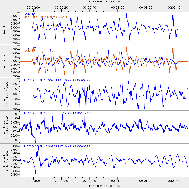
RSSD Black Hills, South Dakota, USA - Earthquake Result Viewer
*The percent match for this event was below the threshold and hence no stack was calculated.
| Earthquake location: |
East Of Kuril Islands |
| Earthquake latitude/longitude: |
47.1/155.5 |
| Earthquake time(UTC): |
2007/01/13 (013) 19:37:32 GMT |
| Earthquake Depth: |
10 km |
| Earthquake Magnitude: |
5.6 MB, 4.7 MS |
| Earthquake Catalog/Contributor: |
WHDF/NEIC |
|
| Network: |
IU Global Seismograph Network (GSN - IRIS/USGS) |
| Station: |
RSSD Black Hills, South Dakota, USA |
| Lat/Lon: |
44.12 N/104.04 W |
| Elevation: |
2060 m |
|
| Distance: |
65.4 deg |
| Az: |
51.196 deg |
| Baz: |
312.28 deg |
| Ray Param: |
$rayparam |
*The percent match for this event was below the threshold and hence was not used in the summary stack. |
|
| Radial Match: |
60.53139 % |
| Radial Bump: |
393 |
| Transverse Match: |
59.640694 % |
| Transverse Bump: |
400 |
| SOD ConfigId: |
590571 |
| Insert Time: |
2013-09-26 05:28:05.631 +0000 |
| GWidth: |
2.5 |
| Max Bumps: |
400 |
| Tol: |
0.001 |
|
Signal To Noise
| Channel | StoN | STA | LTA |
| IU:RSSD:00:BHZ:20070113T19:47:43.860022Z | 1.4527658 | 8.553651E-8 | 5.8878392E-8 |
| IU:RSSD:00:BH1:20070113T19:47:43.860022Z | 2.7327478 | 4.169267E-7 | 1.5256684E-7 |
| IU:RSSD:00:BH2:20070113T19:47:43.860022Z | 0.8488494 | 9.655323E-8 | 1.13746E-7 |
| Arrivals |
| Ps | |
| PpPs | |
| PsPs/PpSs | |


