You are here: Home > Network List > UW - Pacific Northwest Regional Seismic Network Stations List
> Station FISH Seaside, OR, USA > Earthquake Result Viewer
FISH Seaside, OR, USA - Earthquake Result Viewer
*The percent match for this event was below the threshold and hence no stack was calculated.
| Earthquake location: |
Southern East Pacific Rise |
| Earthquake latitude/longitude: |
-32.1/-110.8 |
| Earthquake time(UTC): |
2014/10/09 (282) 02:14:32 GMT |
| Earthquake Depth: |
16 km |
| Earthquake Magnitude: |
7.1 MWW, 6.8 MI |
| Earthquake Catalog/Contributor: |
NEIC PDE/NEIC COMCAT |
|
| Network: |
UW Pacific Northwest Regional Seismic Network |
| Station: |
FISH Seaside, OR, USA |
| Lat/Lon: |
45.93 N/123.56 W |
| Elevation: |
325 m |
|
| Distance: |
78.5 deg |
| Az: |
350.936 deg |
| Baz: |
168.958 deg |
| Ray Param: |
$rayparam |
*The percent match for this event was below the threshold and hence was not used in the summary stack. |
|
| Radial Match: |
60.498547 % |
| Radial Bump: |
400 |
| Transverse Match: |
46.26766 % |
| Transverse Bump: |
400 |
| SOD ConfigId: |
3390531 |
| Insert Time: |
2019-04-14 10:23:10.507 +0000 |
| GWidth: |
2.5 |
| Max Bumps: |
400 |
| Tol: |
0.001 |
|
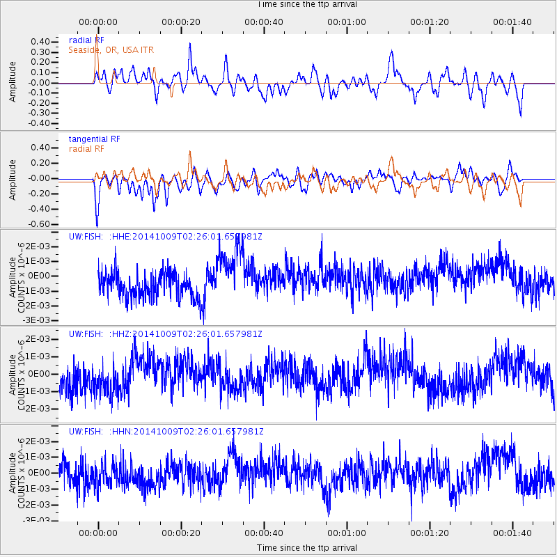
Signal To Noise
| Channel | StoN | STA | LTA |
| UW:FISH: :HHZ:20141009T02:26:01.657981Z | 1.259542 | 9.56107E-10 | 7.59091E-10 |
| UW:FISH: :HHN:20141009T02:26:01.657981Z | 1.0785325 | 7.387344E-10 | 6.8494405E-10 |
| UW:FISH: :HHE:20141009T02:26:01.657981Z | 2.6488287 | 2.1758693E-9 | 8.214458E-10 |
| Arrivals |
| Ps | |
| PpPs | |
| PsPs/PpSs | |


