You are here: Home > Network List > GS - US Geological Survey Networks Stations List
> Station KAN10 Keim Farm > Earthquake Result Viewer
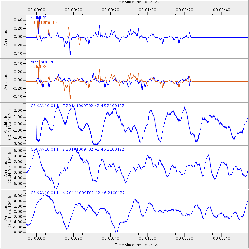
KAN10 Keim Farm - Earthquake Result Viewer
*The percent match for this event was below the threshold and hence no stack was calculated.
| Earthquake location: |
Southern East Pacific Rise |
| Earthquake latitude/longitude: |
-32.1/-110.9 |
| Earthquake time(UTC): |
2014/10/09 (282) 02:32:05 GMT |
| Earthquake Depth: |
10 km |
| Earthquake Magnitude: |
6.6 MWW, 6.6 MWC |
| Earthquake Catalog/Contributor: |
NEIC PDE/NEIC COMCAT |
|
| Network: |
GS US Geological Survey Networks |
| Station: |
KAN10 Keim Farm |
| Lat/Lon: |
37.12 N/98.10 W |
| Elevation: |
417 m |
|
| Distance: |
69.9 deg |
| Az: |
10.864 deg |
| Baz: |
191.544 deg |
| Ray Param: |
$rayparam |
*The percent match for this event was below the threshold and hence was not used in the summary stack. |
|
| Radial Match: |
47.780617 % |
| Radial Bump: |
228 |
| Transverse Match: |
53.00016 % |
| Transverse Bump: |
313 |
| SOD ConfigId: |
3390531 |
| Insert Time: |
2019-04-14 10:29:24.621 +0000 |
| GWidth: |
2.5 |
| Max Bumps: |
400 |
| Tol: |
0.001 |
|
Signal To Noise
| Channel | StoN | STA | LTA |
| GS:KAN10:01:HHZ:20141009T02:42:46.210012Z | 2.2264848 | 4.30513E-6 | 1.9335996E-6 |
| GS:KAN10:01:HHN:20141009T02:42:46.210012Z | 3.318816 | 6.1420365E-6 | 1.850671E-6 |
| GS:KAN10:01:HHE:20141009T02:42:46.210012Z | 2.1291714 | 3.0411306E-6 | 1.4283166E-6 |
| Arrivals |
| Ps | |
| PpPs | |
| PsPs/PpSs | |


