You are here: Home > Network List > IU - Global Seismograph Network (GSN - IRIS/USGS) Stations List
> Station RSSD Black Hills, South Dakota, USA > Earthquake Result Viewer
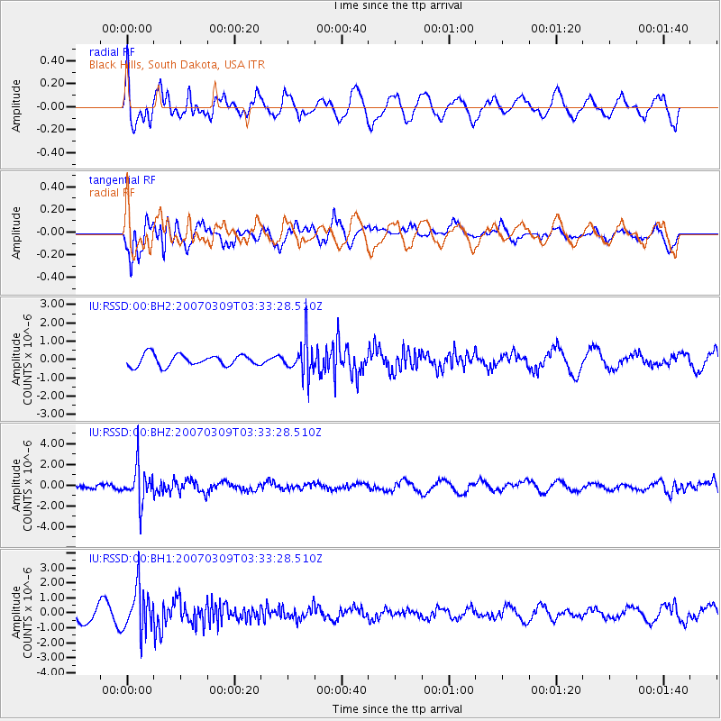
RSSD Black Hills, South Dakota, USA - Earthquake Result Viewer
*The percent match for this event was below the threshold and hence no stack was calculated.
| Earthquake location: |
Primor'ye, Russia |
| Earthquake latitude/longitude: |
43.2/133.5 |
| Earthquake time(UTC): |
2007/03/09 (068) 03:22:42 GMT |
| Earthquake Depth: |
441 km |
| Earthquake Magnitude: |
6.1 MB, 6.0 MW, 6.0 MW |
| Earthquake Catalog/Contributor: |
WHDF/NEIC |
|
| Network: |
IU Global Seismograph Network (GSN - IRIS/USGS) |
| Station: |
RSSD Black Hills, South Dakota, USA |
| Lat/Lon: |
44.12 N/104.04 W |
| Elevation: |
2060 m |
|
| Distance: |
79.0 deg |
| Az: |
38.261 deg |
| Baz: |
321.061 deg |
| Ray Param: |
$rayparam |
*The percent match for this event was below the threshold and hence was not used in the summary stack. |
|
| Radial Match: |
39.17006 % |
| Radial Bump: |
400 |
| Transverse Match: |
72.729645 % |
| Transverse Bump: |
400 |
| SOD ConfigId: |
590571 |
| Insert Time: |
2013-09-26 07:39:10.105 +0000 |
| GWidth: |
2.5 |
| Max Bumps: |
400 |
| Tol: |
0.001 |
|
Signal To Noise
| Channel | StoN | STA | LTA |
| IU:RSSD:00:BHZ:20070309T03:33:28.510Z | 8.340044 | 1.7781518E-6 | 2.1320655E-7 |
| IU:RSSD:00:BH1:20070309T03:33:28.510Z | 3.0605998 | 1.4756569E-6 | 4.821463E-7 |
| IU:RSSD:00:BH2:20070309T03:33:28.510Z | 3.1173747 | 9.712413E-7 | 3.1155744E-7 |
| Arrivals |
| Ps | |
| PpPs | |
| PsPs/PpSs | |


