You are here: Home > Network List > TA - USArray Transportable Network (new EarthScope stations) Stations List
> Station V56A Mocksville, NC, USA > Earthquake Result Viewer
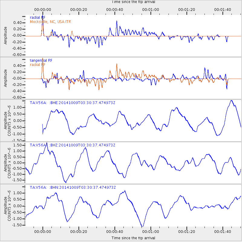
V56A Mocksville, NC, USA - Earthquake Result Viewer
*The percent match for this event was below the threshold and hence no stack was calculated.
| Earthquake location: |
Southern East Pacific Rise |
| Earthquake latitude/longitude: |
-32.1/-110.7 |
| Earthquake time(UTC): |
2014/10/09 (282) 03:19:37 GMT |
| Earthquake Depth: |
10 km |
| Earthquake Magnitude: |
5.2 mb |
| Earthquake Catalog/Contributor: |
ISC/ISC |
|
| Network: |
TA USArray Transportable Network (new EarthScope stations) |
| Station: |
V56A Mocksville, NC, USA |
| Lat/Lon: |
35.81 N/80.50 W |
| Elevation: |
237 m |
|
| Distance: |
73.3 deg |
| Az: |
25.307 deg |
| Baz: |
206.496 deg |
| Ray Param: |
$rayparam |
*The percent match for this event was below the threshold and hence was not used in the summary stack. |
|
| Radial Match: |
51.435505 % |
| Radial Bump: |
400 |
| Transverse Match: |
67.52629 % |
| Transverse Bump: |
400 |
| SOD ConfigId: |
3390531 |
| Insert Time: |
2019-04-14 10:42:04.534 +0000 |
| GWidth: |
2.5 |
| Max Bumps: |
400 |
| Tol: |
0.001 |
|
Signal To Noise
| Channel | StoN | STA | LTA |
| TA:V56A: :BHZ:20141009T03:30:37.474973Z | 3.284695 | 1.2533702E-6 | 3.8157887E-7 |
| TA:V56A: :BHN:20141009T03:30:37.474973Z | 0.47450837 | 4.851579E-7 | 1.0224433E-6 |
| TA:V56A: :BHE:20141009T03:30:37.474973Z | 0.3054177 | 1.861334E-7 | 6.0943887E-7 |
| Arrivals |
| Ps | |
| PpPs | |
| PsPs/PpSs | |


