You are here: Home > Network List > IU - Global Seismograph Network (GSN - IRIS/USGS) Stations List
> Station RSSD Black Hills, South Dakota, USA > Earthquake Result Viewer
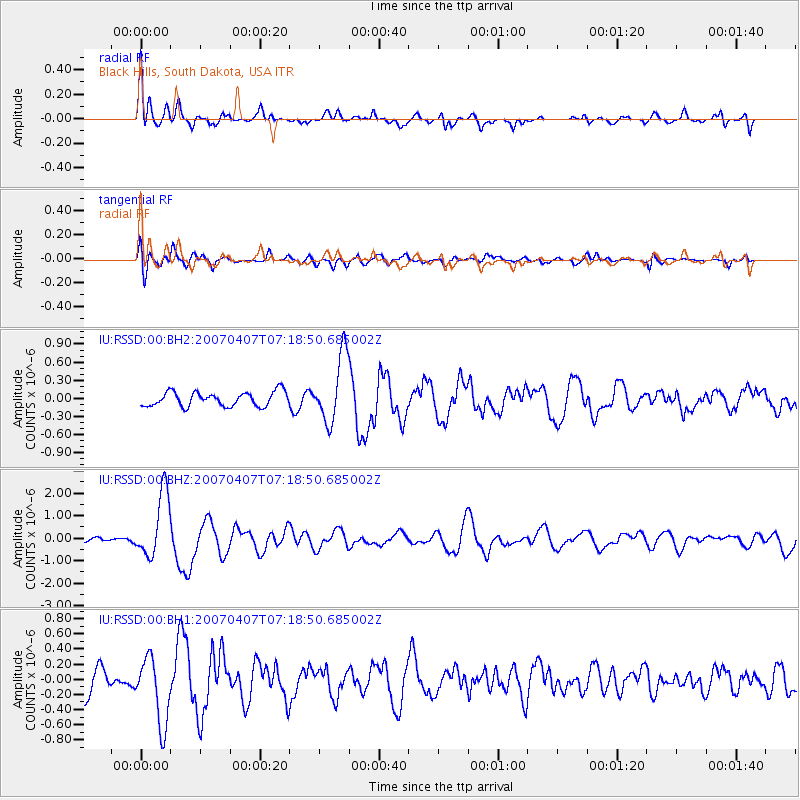
RSSD Black Hills, South Dakota, USA - Earthquake Result Viewer
*The percent match for this event was below the threshold and hence no stack was calculated.
| Earthquake location: |
Azores Islands Region |
| Earthquake latitude/longitude: |
37.3/-24.5 |
| Earthquake time(UTC): |
2007/04/07 (097) 07:09:25 GMT |
| Earthquake Depth: |
8.0 km |
| Earthquake Magnitude: |
5.9 MB, 5.9 MS, 6.1 MW, 6.0 MW |
| Earthquake Catalog/Contributor: |
WHDF/NEIC |
|
| Network: |
IU Global Seismograph Network (GSN - IRIS/USGS) |
| Station: |
RSSD Black Hills, South Dakota, USA |
| Lat/Lon: |
44.12 N/104.04 W |
| Elevation: |
2060 m |
|
| Distance: |
58.5 deg |
| Az: |
303.809 deg |
| Baz: |
66.914 deg |
| Ray Param: |
$rayparam |
*The percent match for this event was below the threshold and hence was not used in the summary stack. |
|
| Radial Match: |
78.202065 % |
| Radial Bump: |
400 |
| Transverse Match: |
53.14345 % |
| Transverse Bump: |
400 |
| SOD ConfigId: |
590571 |
| Insert Time: |
2013-09-26 10:00:08.814 +0000 |
| GWidth: |
2.5 |
| Max Bumps: |
400 |
| Tol: |
0.001 |
|
Signal To Noise
| Channel | StoN | STA | LTA |
| IU:RSSD:00:BHZ:20070407T07:18:50.685002Z | 11.571191 | 1.4412699E-6 | 1.2455675E-7 |
| IU:RSSD:00:BH1:20070407T07:18:50.685002Z | 1.9055259 | 4.4290852E-7 | 2.3243373E-7 |
| IU:RSSD:00:BH2:20070407T07:18:50.685002Z | 4.6755104 | 5.529608E-7 | 1.1826747E-7 |
| Arrivals |
| Ps | |
| PpPs | |
| PsPs/PpSs | |


