You are here: Home > Network List > IU - Global Seismograph Network (GSN - IRIS/USGS) Stations List
> Station RSSD Black Hills, South Dakota, USA > Earthquake Result Viewer
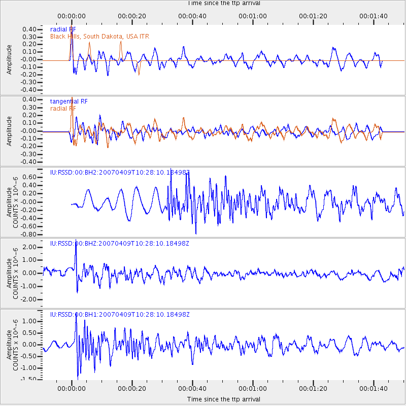
RSSD Black Hills, South Dakota, USA - Earthquake Result Viewer
*The percent match for this event was below the threshold and hence no stack was calculated.
| Earthquake location: |
Kuril Islands |
| Earthquake latitude/longitude: |
48.3/154.7 |
| Earthquake time(UTC): |
2007/04/09 (099) 10:18:04 GMT |
| Earthquake Depth: |
36 km |
| Earthquake Magnitude: |
5.8 MB, 5.4 MS, 5.8 MW, 5.7 MW |
| Earthquake Catalog/Contributor: |
WHDF/NEIC |
|
| Network: |
IU Global Seismograph Network (GSN - IRIS/USGS) |
| Station: |
RSSD Black Hills, South Dakota, USA |
| Lat/Lon: |
44.12 N/104.04 W |
| Elevation: |
2060 m |
|
| Distance: |
65.0 deg |
| Az: |
51.197 deg |
| Baz: |
313.743 deg |
| Ray Param: |
$rayparam |
*The percent match for this event was below the threshold and hence was not used in the summary stack. |
|
| Radial Match: |
61.433197 % |
| Radial Bump: |
400 |
| Transverse Match: |
40.262245 % |
| Transverse Bump: |
400 |
| SOD ConfigId: |
590571 |
| Insert Time: |
2013-09-26 10:04:52.428 +0000 |
| GWidth: |
2.5 |
| Max Bumps: |
400 |
| Tol: |
0.001 |
|
Signal To Noise
| Channel | StoN | STA | LTA |
| IU:RSSD:00:BHZ:20070409T10:28:10.18498Z | 3.5678964 | 8.4372385E-7 | 2.3647657E-7 |
| IU:RSSD:00:BH1:20070409T10:28:10.18498Z | 2.716495 | 6.339502E-7 | 2.3337067E-7 |
| IU:RSSD:00:BH2:20070409T10:28:10.18498Z | 1.3578923 | 2.6327515E-7 | 1.9388517E-7 |
| Arrivals |
| Ps | |
| PpPs | |
| PsPs/PpSs | |


