You are here: Home > Network List > IU - Global Seismograph Network (GSN - IRIS/USGS) Stations List
> Station RSSD Black Hills, South Dakota, USA > Earthquake Result Viewer
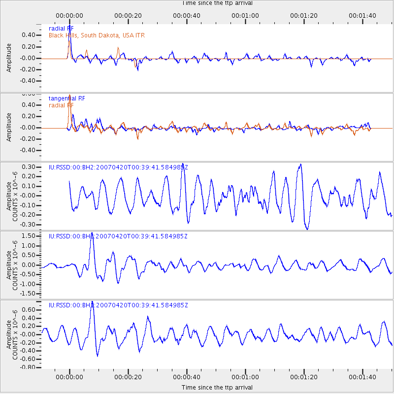
RSSD Black Hills, South Dakota, USA - Earthquake Result Viewer
*The percent match for this event was below the threshold and hence no stack was calculated.
| Earthquake location: |
Southwestern Ryukyu Isl., Japan |
| Earthquake latitude/longitude: |
25.7/125.1 |
| Earthquake time(UTC): |
2007/04/20 (110) 00:26:40 GMT |
| Earthquake Depth: |
10 km |
| Earthquake Magnitude: |
5.6 MB, 6.1 MS, 6.1 MW, 6.0 MW |
| Earthquake Catalog/Contributor: |
WHDF/NEIC |
|
| Network: |
IU Global Seismograph Network (GSN - IRIS/USGS) |
| Station: |
RSSD Black Hills, South Dakota, USA |
| Lat/Lon: |
44.12 N/104.04 W |
| Elevation: |
2060 m |
|
| Distance: |
97.2 deg |
| Az: |
33.296 deg |
| Baz: |
316.562 deg |
| Ray Param: |
$rayparam |
*The percent match for this event was below the threshold and hence was not used in the summary stack. |
|
| Radial Match: |
79.32814 % |
| Radial Bump: |
254 |
| Transverse Match: |
56.72705 % |
| Transverse Bump: |
400 |
| SOD ConfigId: |
590571 |
| Insert Time: |
2013-09-26 10:25:43.499 +0000 |
| GWidth: |
2.5 |
| Max Bumps: |
400 |
| Tol: |
0.001 |
|
Signal To Noise
| Channel | StoN | STA | LTA |
| IU:RSSD:00:BHZ:20070420T00:39:41.584985Z | 2.698207 | 2.6578607E-7 | 9.85047E-8 |
| IU:RSSD:00:BH1:20070420T00:39:41.584985Z | 2.1269505 | 2.0064388E-7 | 9.433406E-8 |
| IU:RSSD:00:BH2:20070420T00:39:41.584985Z | 1.0340134 | 1.1369742E-7 | 1.0995739E-7 |
| Arrivals |
| Ps | |
| PpPs | |
| PsPs/PpSs | |


