You are here: Home > Network List > GS - US Geological Survey Networks Stations List
> Station KAN13 Rinehart Farm > Earthquake Result Viewer
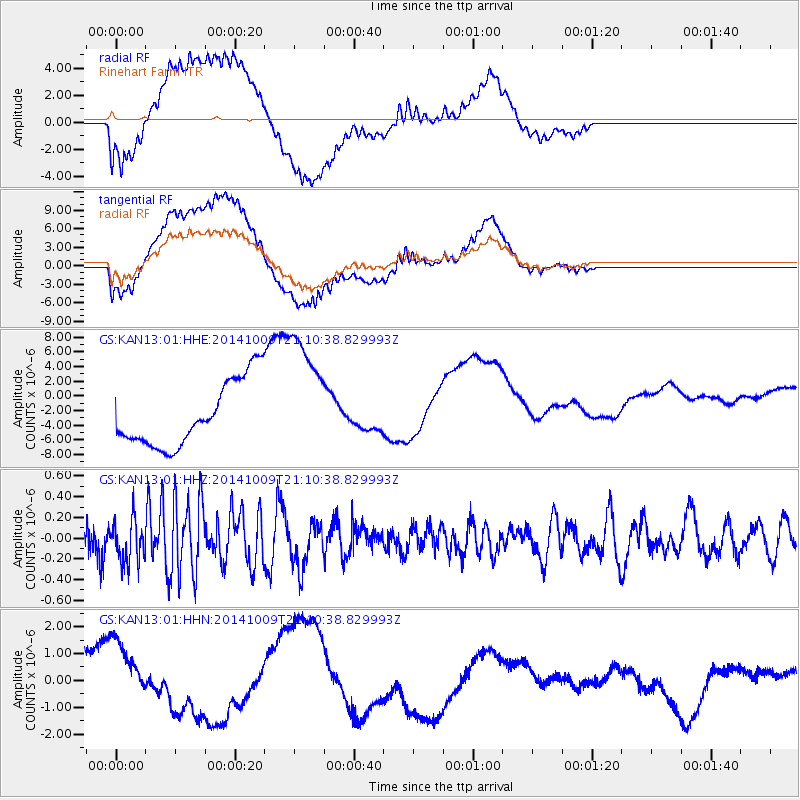
KAN13 Rinehart Farm - Earthquake Result Viewer
*The percent match for this event was below the threshold and hence no stack was calculated.
| Earthquake location: |
Easter Island Region |
| Earthquake latitude/longitude: |
-32.0/-111.1 |
| Earthquake time(UTC): |
2014/10/09 (282) 21:00:00 GMT |
| Earthquake Depth: |
10 km |
| Earthquake Magnitude: |
5.7 MWW, 5.6 MWC |
| Earthquake Catalog/Contributor: |
NEIC PDE/NEIC COMCAT |
|
| Network: |
GS US Geological Survey Networks |
| Station: |
KAN13 Rinehart Farm |
| Lat/Lon: |
37.01 N/97.48 W |
| Elevation: |
340 m |
|
| Distance: |
69.8 deg |
| Az: |
11.618 deg |
| Baz: |
192.345 deg |
| Ray Param: |
$rayparam |
*The percent match for this event was below the threshold and hence was not used in the summary stack. |
|
| Radial Match: |
80.92095 % |
| Radial Bump: |
400 |
| Transverse Match: |
69.08639 % |
| Transverse Bump: |
400 |
| SOD ConfigId: |
3390531 |
| Insert Time: |
2019-04-14 10:57:53.637 +0000 |
| GWidth: |
2.5 |
| Max Bumps: |
400 |
| Tol: |
0.001 |
|
Signal To Noise
| Channel | StoN | STA | LTA |
| GS:KAN13:01:HHZ:20141009T21:10:38.829993Z | 1.34463 | 2.0651134E-7 | 1.5358229E-7 |
| GS:KAN13:01:HHN:20141009T21:10:38.829993Z | 1.2006369 | 1.2869739E-6 | 1.0719093E-6 |
| GS:KAN13:01:HHE:20141009T21:10:38.829993Z | 1.6479774 | 7.694834E-6 | 4.6692594E-6 |
| Arrivals |
| Ps | |
| PpPs | |
| PsPs/PpSs | |


