You are here: Home > Network List > IU - Global Seismograph Network (GSN - IRIS/USGS) Stations List
> Station RSSD Black Hills, South Dakota, USA > Earthquake Result Viewer
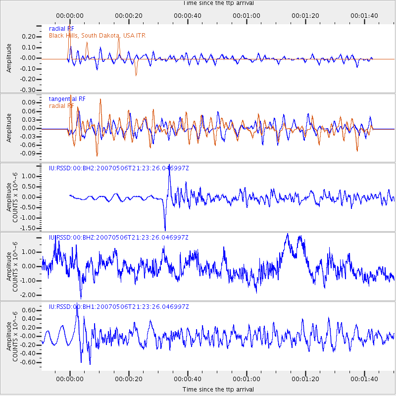
RSSD Black Hills, South Dakota, USA - Earthquake Result Viewer
*The percent match for this event was below the threshold and hence no stack was calculated.
| Earthquake location: |
Fiji Islands Region |
| Earthquake latitude/longitude: |
-19.4/-179.4 |
| Earthquake time(UTC): |
2007/05/06 (126) 21:11:52 GMT |
| Earthquake Depth: |
676 km |
| Earthquake Magnitude: |
6.0 MB, 6.5 MW, 6.4 MW |
| Earthquake Catalog/Contributor: |
WHDF/NEIC |
|
| Network: |
IU Global Seismograph Network (GSN - IRIS/USGS) |
| Station: |
RSSD Black Hills, South Dakota, USA |
| Lat/Lon: |
44.12 N/104.04 W |
| Elevation: |
2060 m |
|
| Distance: |
93.3 deg |
| Az: |
44.252 deg |
| Baz: |
246.144 deg |
| Ray Param: |
$rayparam |
*The percent match for this event was below the threshold and hence was not used in the summary stack. |
|
| Radial Match: |
30.728611 % |
| Radial Bump: |
400 |
| Transverse Match: |
47.11948 % |
| Transverse Bump: |
400 |
| SOD ConfigId: |
590571 |
| Insert Time: |
2013-09-26 11:11:01.776 +0000 |
| GWidth: |
2.5 |
| Max Bumps: |
400 |
| Tol: |
0.001 |
|
Signal To Noise
| Channel | StoN | STA | LTA |
| IU:RSSD:00:BHZ:20070506T21:23:26.046997Z | 1.6173389 | 8.223638E-7 | 5.084672E-7 |
| IU:RSSD:00:BH1:20070506T21:23:26.046997Z | 2.5425215 | 3.207735E-7 | 1.2616353E-7 |
| IU:RSSD:00:BH2:20070506T21:23:26.046997Z | 7.0084133 | 5.9778273E-7 | 8.5295014E-8 |
| Arrivals |
| Ps | |
| PpPs | |
| PsPs/PpSs | |


