You are here: Home > Network List > IU - Global Seismograph Network (GSN - IRIS/USGS) Stations List
> Station RSSD Black Hills, South Dakota, USA > Earthquake Result Viewer
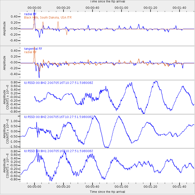
RSSD Black Hills, South Dakota, USA - Earthquake Result Viewer
*The percent match for this event was below the threshold and hence no stack was calculated.
| Earthquake location: |
Kuril Islands |
| Earthquake latitude/longitude: |
48.9/154.8 |
| Earthquake time(UTC): |
2007/05/16 (136) 10:17:45 GMT |
| Earthquake Depth: |
10 km |
| Earthquake Magnitude: |
5.5 MB |
| Earthquake Catalog/Contributor: |
WHDF/NEIC |
|
| Network: |
IU Global Seismograph Network (GSN - IRIS/USGS) |
| Station: |
RSSD Black Hills, South Dakota, USA |
| Lat/Lon: |
44.12 N/104.04 W |
| Elevation: |
2060 m |
|
| Distance: |
64.6 deg |
| Az: |
51.44 deg |
| Baz: |
314.188 deg |
| Ray Param: |
$rayparam |
*The percent match for this event was below the threshold and hence was not used in the summary stack. |
|
| Radial Match: |
62.357162 % |
| Radial Bump: |
400 |
| Transverse Match: |
88.18622 % |
| Transverse Bump: |
400 |
| SOD ConfigId: |
590571 |
| Insert Time: |
2013-09-26 11:33:19.155 +0000 |
| GWidth: |
2.5 |
| Max Bumps: |
400 |
| Tol: |
0.001 |
|
Signal To Noise
| Channel | StoN | STA | LTA |
| IU:RSSD:00:BHZ:20070516T10:27:51.598008Z | 1.3384588 | 3.9504195E-7 | 2.951469E-7 |
| IU:RSSD:00:BH1:20070516T10:27:51.598008Z | 2.3164608 | 5.361031E-7 | 2.3143195E-7 |
| IU:RSSD:00:BH2:20070516T10:27:51.598008Z | 2.141906 | 3.2200492E-7 | 1.5033568E-7 |
| Arrivals |
| Ps | |
| PpPs | |
| PsPs/PpSs | |


