You are here: Home > Network List > IU - Global Seismograph Network (GSN - IRIS/USGS) Stations List
> Station RSSD Black Hills, South Dakota, USA > Earthquake Result Viewer
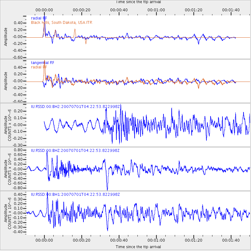
RSSD Black Hills, South Dakota, USA - Earthquake Result Viewer
*The percent match for this event was below the threshold and hence no stack was calculated.
| Earthquake location: |
Hokkaido, Japan Region |
| Earthquake latitude/longitude: |
43.7/144.7 |
| Earthquake time(UTC): |
2007/07/01 (182) 04:12:07 GMT |
| Earthquake Depth: |
130 km |
| Earthquake Magnitude: |
5.5 MB, 5.8 MW, 5.8 MW |
| Earthquake Catalog/Contributor: |
WHDF/NEIC |
|
| Network: |
IU Global Seismograph Network (GSN - IRIS/USGS) |
| Station: |
RSSD Black Hills, South Dakota, USA |
| Lat/Lon: |
44.12 N/104.04 W |
| Elevation: |
2060 m |
|
| Distance: |
73.3 deg |
| Az: |
44.511 deg |
| Baz: |
315.056 deg |
| Ray Param: |
$rayparam |
*The percent match for this event was below the threshold and hence was not used in the summary stack. |
|
| Radial Match: |
69.835594 % |
| Radial Bump: |
400 |
| Transverse Match: |
74.826164 % |
| Transverse Bump: |
400 |
| SOD ConfigId: |
590571 |
| Insert Time: |
2013-09-26 12:33:39.953 +0000 |
| GWidth: |
2.5 |
| Max Bumps: |
400 |
| Tol: |
0.001 |
|
Signal To Noise
| Channel | StoN | STA | LTA |
| IU:RSSD:00:BHZ:20070701T04:22:53.822998Z | 4.725979 | 2.9760042E-7 | 6.297117E-8 |
| IU:RSSD:00:BH1:20070701T04:22:53.822998Z | 3.1561415 | 1.5286965E-7 | 4.843561E-8 |
| IU:RSSD:00:BH2:20070701T04:22:53.822998Z | 1.8517184 | 9.462048E-8 | 5.1098745E-8 |
| Arrivals |
| Ps | |
| PpPs | |
| PsPs/PpSs | |


