You are here: Home > Network List > IU - Global Seismograph Network (GSN - IRIS/USGS) Stations List
> Station RSSD Black Hills, South Dakota, USA > Earthquake Result Viewer
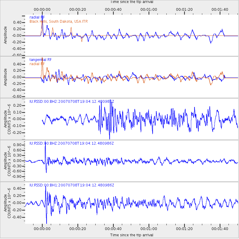
RSSD Black Hills, South Dakota, USA - Earthquake Result Viewer
*The percent match for this event was below the threshold and hence no stack was calculated.
| Earthquake location: |
East Of Kuril Islands |
| Earthquake latitude/longitude: |
46.8/155.5 |
| Earthquake time(UTC): |
2007/07/08 (189) 18:54:00 GMT |
| Earthquake Depth: |
10 km |
| Earthquake Magnitude: |
5.5 MB, 4.4 MS |
| Earthquake Catalog/Contributor: |
WHDF/NEIC |
|
| Network: |
IU Global Seismograph Network (GSN - IRIS/USGS) |
| Station: |
RSSD Black Hills, South Dakota, USA |
| Lat/Lon: |
44.12 N/104.04 W |
| Elevation: |
2060 m |
|
| Distance: |
65.5 deg |
| Az: |
51.092 deg |
| Baz: |
312.118 deg |
| Ray Param: |
$rayparam |
*The percent match for this event was below the threshold and hence was not used in the summary stack. |
|
| Radial Match: |
64.03033 % |
| Radial Bump: |
400 |
| Transverse Match: |
55.657547 % |
| Transverse Bump: |
400 |
| SOD ConfigId: |
590571 |
| Insert Time: |
2013-09-26 12:39:40.137 +0000 |
| GWidth: |
2.5 |
| Max Bumps: |
400 |
| Tol: |
0.001 |
|
Signal To Noise
| Channel | StoN | STA | LTA |
| IU:RSSD:00:BHZ:20070708T19:04:12.480986Z | 4.107215 | 2.8787355E-7 | 7.008972E-8 |
| IU:RSSD:00:BH1:20070708T19:04:12.480986Z | 5.064754 | 1.9634543E-7 | 3.8767023E-8 |
| IU:RSSD:00:BH2:20070708T19:04:12.480986Z | 2.4389558 | 8.8617654E-8 | 3.633426E-8 |
| Arrivals |
| Ps | |
| PpPs | |
| PsPs/PpSs | |


