
KSU1 Kansas State University--Konza Prairie, Kansas, USA - Earthquake Result Viewer
| ||||||||||||||||||
| ||||||||||||||||||
| ||||||||||||||||||
|
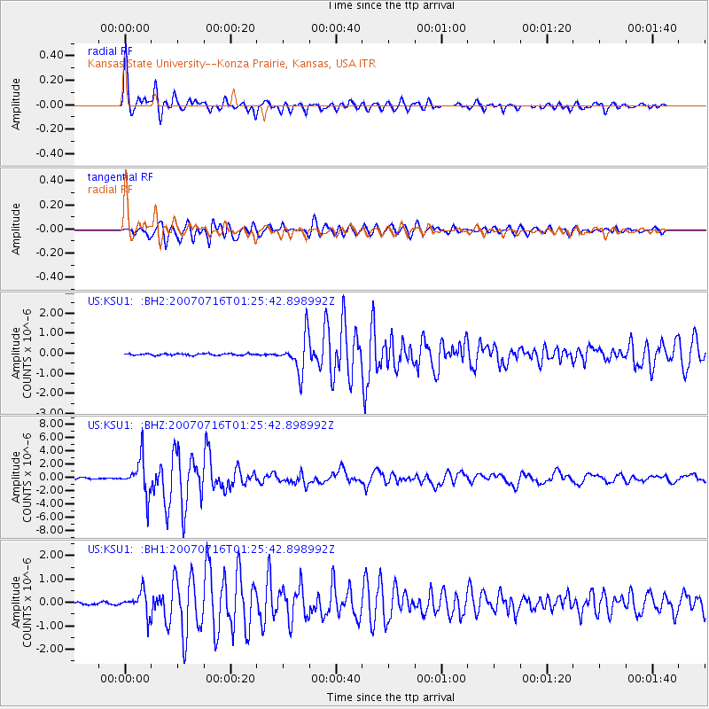
Signal To Noise
| Channel | StoN | STA | LTA |
| US:KSU1: :BHZ:20070716T01:25:42.898992Z | 32.24942 | 2.706845E-6 | 8.393469E-8 |
| US:KSU1: :BH1:20070716T01:25:42.898992Z | 8.517995 | 4.8304895E-7 | 5.670923E-8 |
| US:KSU1: :BH2:20070716T01:25:42.898992Z | 22.390244 | 9.1622894E-7 | 4.0920902E-8 |
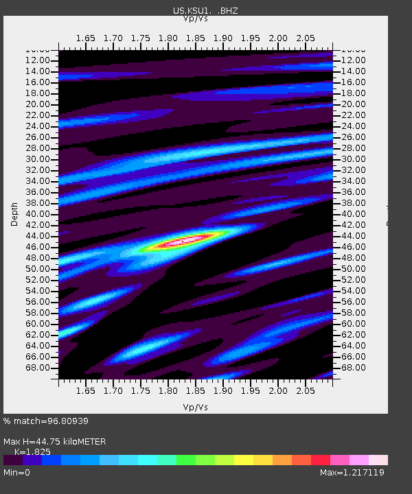
| Arrivals | |
| Ps | 5.8 SECOND |
| PpPs | 19 SECOND |
| PsPs/PpSs | 25 SECOND |

