You are here: Home > Network List > IU - Global Seismograph Network (GSN - IRIS/USGS) Stations List
> Station RSSD Black Hills, South Dakota, USA > Earthquake Result Viewer
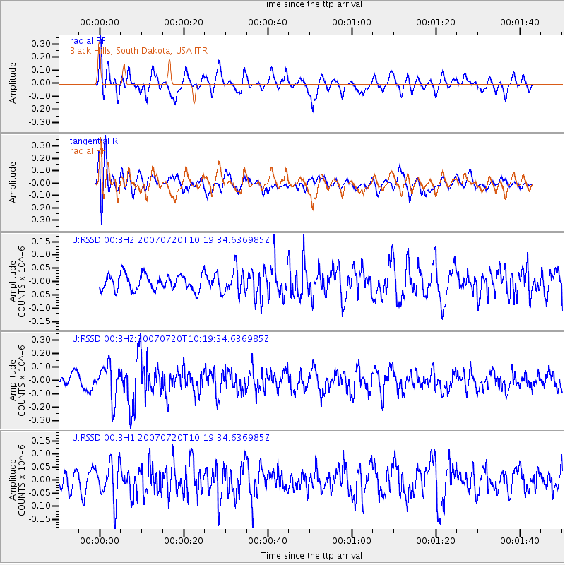
RSSD Black Hills, South Dakota, USA - Earthquake Result Viewer
*The percent match for this event was below the threshold and hence no stack was calculated.
| Earthquake location: |
Northern Xinjiang, China |
| Earthquake latitude/longitude: |
42.9/82.4 |
| Earthquake time(UTC): |
2007/07/20 (201) 10:06:52 GMT |
| Earthquake Depth: |
10 km |
| Earthquake Magnitude: |
5.5 MB, 5.3 MS, 5.6 MW, 5.5 MW |
| Earthquake Catalog/Contributor: |
WHDF/NEIC |
|
| Network: |
IU Global Seismograph Network (GSN - IRIS/USGS) |
| Station: |
RSSD Black Hills, South Dakota, USA |
| Lat/Lon: |
44.12 N/104.04 W |
| Elevation: |
2060 m |
|
| Distance: |
93.2 deg |
| Az: |
4.622 deg |
| Baz: |
355.285 deg |
| Ray Param: |
$rayparam |
*The percent match for this event was below the threshold and hence was not used in the summary stack. |
|
| Radial Match: |
66.88759 % |
| Radial Bump: |
400 |
| Transverse Match: |
62.902283 % |
| Transverse Bump: |
400 |
| SOD ConfigId: |
590571 |
| Insert Time: |
2013-09-26 12:55:31.705 +0000 |
| GWidth: |
2.5 |
| Max Bumps: |
400 |
| Tol: |
0.001 |
|
Signal To Noise
| Channel | StoN | STA | LTA |
| IU:RSSD:00:BHZ:20070720T10:19:34.636985Z | 2.573554 | 1.3199491E-7 | 5.1288957E-8 |
| IU:RSSD:00:BH1:20070720T10:19:34.636985Z | 1.5662209 | 7.233874E-8 | 4.6186805E-8 |
| IU:RSSD:00:BH2:20070720T10:19:34.636985Z | 1.6023141 | 4.654921E-8 | 2.905124E-8 |
| Arrivals |
| Ps | |
| PpPs | |
| PsPs/PpSs | |


