You are here: Home > Network List > TA - USArray Transportable Network (new EarthScope stations) Stations List
> Station O03E Paynes Creek, CA, USA > Earthquake Result Viewer
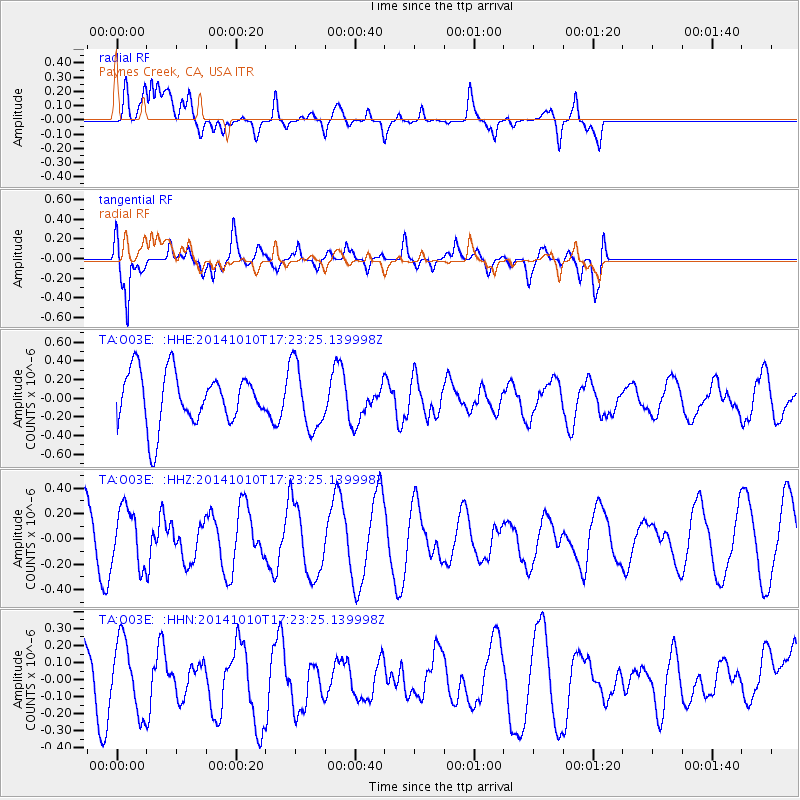
O03E Paynes Creek, CA, USA - Earthquake Result Viewer
*The percent match for this event was below the threshold and hence no stack was calculated.
| Earthquake location: |
Southern East Pacific Rise |
| Earthquake latitude/longitude: |
-32.7/-111.7 |
| Earthquake time(UTC): |
2014/10/10 (283) 17:12:25 GMT |
| Earthquake Depth: |
10 km |
| Earthquake Magnitude: |
5.2 MW |
| Earthquake Catalog/Contributor: |
ISC/ISC |
|
| Network: |
TA USArray Transportable Network (new EarthScope stations) |
| Station: |
O03E Paynes Creek, CA, USA |
| Lat/Lon: |
40.29 N/121.80 W |
| Elevation: |
967 m |
|
| Distance: |
73.2 deg |
| Az: |
351.975 deg |
| Baz: |
171.147 deg |
| Ray Param: |
$rayparam |
*The percent match for this event was below the threshold and hence was not used in the summary stack. |
|
| Radial Match: |
46.497116 % |
| Radial Bump: |
400 |
| Transverse Match: |
68.736305 % |
| Transverse Bump: |
400 |
| SOD ConfigId: |
3390531 |
| Insert Time: |
2019-04-14 11:23:58.840 +0000 |
| GWidth: |
2.5 |
| Max Bumps: |
400 |
| Tol: |
0.001 |
|
Signal To Noise
| Channel | StoN | STA | LTA |
| TA:O03E: :HHZ:20141010T17:23:25.139998Z | 1.0637223 | 2.2483654E-7 | 2.113677E-7 |
| TA:O03E: :HHN:20141010T17:23:25.139998Z | 1.1165854 | 2.0801782E-7 | 1.8629818E-7 |
| TA:O03E: :HHE:20141010T17:23:25.139998Z | 1.2358278 | 3.4741834E-7 | 2.8112197E-7 |
| Arrivals |
| Ps | |
| PpPs | |
| PsPs/PpSs | |


