You are here: Home > Network List > IU - Global Seismograph Network (GSN - IRIS/USGS) Stations List
> Station RSSD Black Hills, South Dakota, USA > Earthquake Result Viewer
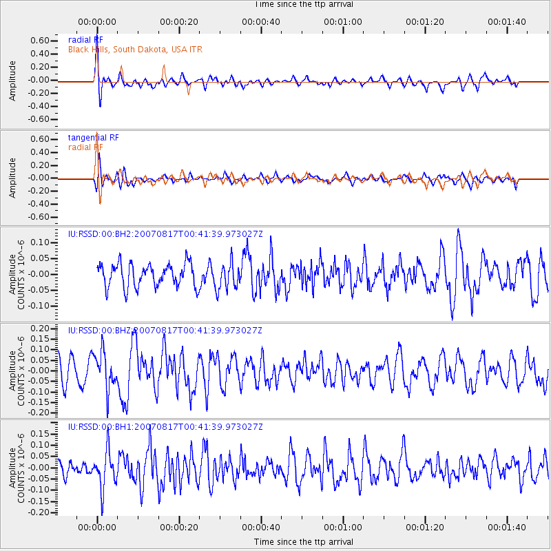
RSSD Black Hills, South Dakota, USA - Earthquake Result Viewer
*The percent match for this event was below the threshold and hence no stack was calculated.
| Earthquake location: |
Near Coast Of Peru |
| Earthquake latitude/longitude: |
-14.4/-76.1 |
| Earthquake time(UTC): |
2007/08/17 (229) 00:31:43 GMT |
| Earthquake Depth: |
31 km |
| Earthquake Magnitude: |
5.5 MW |
| Earthquake Catalog/Contributor: |
NEIC PDE/NEIC PDE-M |
|
| Network: |
IU Global Seismograph Network (GSN - IRIS/USGS) |
| Station: |
RSSD Black Hills, South Dakota, USA |
| Lat/Lon: |
44.12 N/104.04 W |
| Elevation: |
2060 m |
|
| Distance: |
63.6 deg |
| Az: |
337.888 deg |
| Baz: |
149.578 deg |
| Ray Param: |
$rayparam |
*The percent match for this event was below the threshold and hence was not used in the summary stack. |
|
| Radial Match: |
63.92574 % |
| Radial Bump: |
400 |
| Transverse Match: |
41.91337 % |
| Transverse Bump: |
400 |
| SOD ConfigId: |
590571 |
| Insert Time: |
2013-09-26 13:55:45.609 +0000 |
| GWidth: |
2.5 |
| Max Bumps: |
400 |
| Tol: |
0.001 |
|
Signal To Noise
| Channel | StoN | STA | LTA |
| IU:RSSD:00:BHZ:20070817T00:41:39.973027Z | 1.3099216 | 8.700955E-8 | 6.642348E-8 |
| IU:RSSD:00:BH1:20070817T00:41:39.973027Z | 2.2447462 | 8.428926E-8 | 3.7549576E-8 |
| IU:RSSD:00:BH2:20070817T00:41:39.973027Z | 1.1736981 | 4.2388592E-8 | 3.6115413E-8 |
| Arrivals |
| Ps | |
| PpPs | |
| PsPs/PpSs | |


