You are here: Home > Network List > IU - Global Seismograph Network (GSN - IRIS/USGS) Stations List
> Station RSSD Black Hills, South Dakota, USA > Earthquake Result Viewer
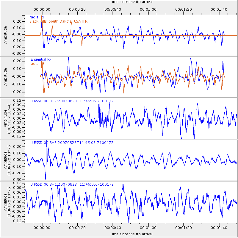
RSSD Black Hills, South Dakota, USA - Earthquake Result Viewer
*The percent match for this event was below the threshold and hence no stack was calculated.
| Earthquake location: |
Fiji Islands Region |
| Earthquake latitude/longitude: |
-19.9/-177.7 |
| Earthquake time(UTC): |
2007/08/23 (235) 11:34:24 GMT |
| Earthquake Depth: |
554 km |
| Earthquake Magnitude: |
5.7 MW |
| Earthquake Catalog/Contributor: |
NEIC PDE/NEIC PDE-M |
|
| Network: |
IU Global Seismograph Network (GSN - IRIS/USGS) |
| Station: |
RSSD Black Hills, South Dakota, USA |
| Lat/Lon: |
44.12 N/104.04 W |
| Elevation: |
2060 m |
|
| Distance: |
92.6 deg |
| Az: |
43.78 deg |
| Baz: |
244.671 deg |
| Ray Param: |
$rayparam |
*The percent match for this event was below the threshold and hence was not used in the summary stack. |
|
| Radial Match: |
54.81479 % |
| Radial Bump: |
400 |
| Transverse Match: |
54.223885 % |
| Transverse Bump: |
400 |
| SOD ConfigId: |
590571 |
| Insert Time: |
2013-09-26 14:12:35.686 +0000 |
| GWidth: |
2.5 |
| Max Bumps: |
400 |
| Tol: |
0.001 |
|
Signal To Noise
| Channel | StoN | STA | LTA |
| IU:RSSD:00:BHZ:20070823T11:46:05.710017Z | 1.8926847 | 1.11105884E-7 | 5.87028E-8 |
| IU:RSSD:00:BH1:20070823T11:46:05.710017Z | 0.58425844 | 2.6912437E-8 | 4.6062553E-8 |
| IU:RSSD:00:BH2:20070823T11:46:05.710017Z | 1.1657808 | 4.126531E-8 | 3.5397143E-8 |
| Arrivals |
| Ps | |
| PpPs | |
| PsPs/PpSs | |


