You are here: Home > Network List > IU - Global Seismograph Network (GSN - IRIS/USGS) Stations List
> Station RSSD Black Hills, South Dakota, USA > Earthquake Result Viewer
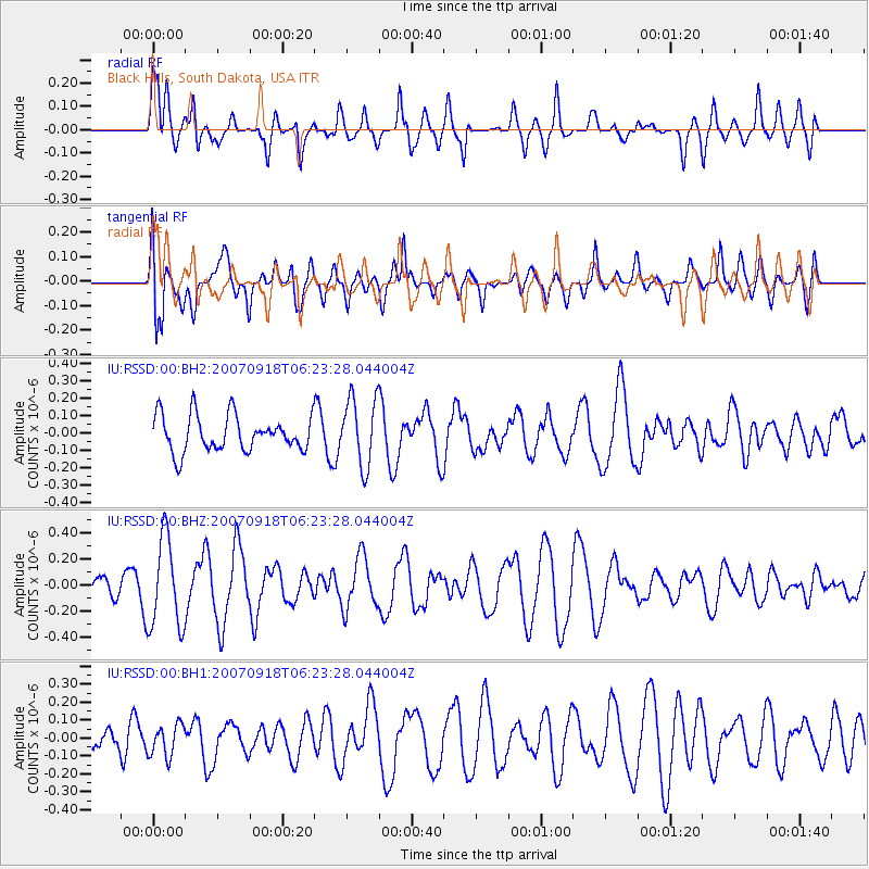
RSSD Black Hills, South Dakota, USA - Earthquake Result Viewer
*The percent match for this event was below the threshold and hence no stack was calculated.
| Earthquake location: |
Fiji Islands |
| Earthquake latitude/longitude: |
-15.4/179.9 |
| Earthquake time(UTC): |
2007/09/18 (261) 06:10:59 GMT |
| Earthquake Depth: |
38 km |
| Earthquake Magnitude: |
5.5 MW |
| Earthquake Catalog/Contributor: |
NEIC PDE/NEIC PDE-M |
|
| Network: |
IU Global Seismograph Network (GSN - IRIS/USGS) |
| Station: |
RSSD Black Hills, South Dakota, USA |
| Lat/Lon: |
44.12 N/104.04 W |
| Elevation: |
2060 m |
|
| Distance: |
90.9 deg |
| Az: |
44.358 deg |
| Baz: |
249.429 deg |
| Ray Param: |
$rayparam |
*The percent match for this event was below the threshold and hence was not used in the summary stack. |
|
| Radial Match: |
67.54844 % |
| Radial Bump: |
400 |
| Transverse Match: |
56.916023 % |
| Transverse Bump: |
400 |
| SOD ConfigId: |
590571 |
| Insert Time: |
2013-09-26 14:54:56.309 +0000 |
| GWidth: |
2.5 |
| Max Bumps: |
400 |
| Tol: |
0.001 |
|
Signal To Noise
| Channel | StoN | STA | LTA |
| IU:RSSD:00:BHZ:20070918T06:23:28.044004Z | 1.8023866 | 3.442642E-7 | 1.9100464E-7 |
| IU:RSSD:00:BH1:20070918T06:23:28.044004Z | 0.8655782 | 8.877652E-8 | 1.02563256E-7 |
| IU:RSSD:00:BH2:20070918T06:23:28.044004Z | 1.9151245 | 1.9562016E-7 | 1.02144874E-7 |
| Arrivals |
| Ps | |
| PpPs | |
| PsPs/PpSs | |


