TATO Taipei, Taiwan - Earthquake Result Viewer
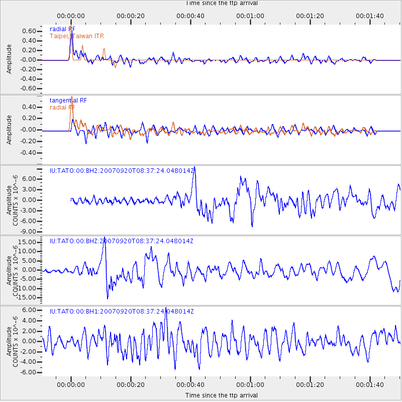
Earthquake location: Southern Sumatra, Indonesia
Earthquake latitude/longitude: -2.0/100.1
Earthquake time(UTC): 2007/09/20 (263) 08:31:14 GMT
Earthquake Depth: 30 km
Earthquake Magnitude: 6.3 MB, 6.8 MS, 6.7 MW, 6.3 ME
Earthquake Catalog/Contributor: WHDF/NEIC
Network: IU Global Seismograph Network (GSN - IRIS/USGS)
Station: TATO Taipei, Taiwan
Lat/Lon: 24.98 N/121.49 E
Elevation: 53 m
Distance: 33.9 deg
Az: 36.349 deg
Baz: 220.744 deg
Ray Param: 0.07796022
Estimated Moho Depth: 25.75 km
Estimated Crust Vp/Vs: 1.79
Assumed Crust Vp: 6.289 km/s
Estimated Crust Vs: 3.523 km/s
Estimated Crust Poisson's Ratio: 0.27
Radial Match: 90.33629 %
Radial Bump: 400
Transverse Match: 77.27959 %
Transverse Bump: 400
SOD ConfigId: 590571
Insert Time: 2013-09-26 14:57:38.938 +0000
GWidth: 2.5
Max Bumps: 400
Tol: 0.001

Signal To Noise

ChannelStoNSTALTA
IU:TATO:00:BHZ:20070920T08:37:24.048014Z2.9728741.9857139E-66.679442E-7
IU:TATO:00:BH1:20070920T08:37:24.048014Z1.21526341.1715025E-69.639906E-7
IU:TATO:00:BH2:20070920T08:37:24.048014Z1.40451637.831664E-75.5760574E-7
Arrivals
Ps3.5 SECOND
PpPs11 SECOND
PsPs/PpSs14 SECOND