
TATO Taipei, Taiwan - Earthquake Result Viewer
| ||||||||||||||||||
| ||||||||||||||||||
| ||||||||||||||||||
|

Signal To Noise
| Channel | StoN | STA | LTA |
| IU:TATO:00:BHZ:20071024T21:09:10.147999Z | 5.1855288 | 4.8756306E-6 | 9.4023784E-7 |
| IU:TATO:00:BH1:20071024T21:09:10.147999Z | 2.0945108 | 2.4023882E-6 | 1.1469924E-6 |
| IU:TATO:00:BH2:20071024T21:09:10.147999Z | 2.7296026 | 3.0447754E-6 | 1.1154648E-6 |
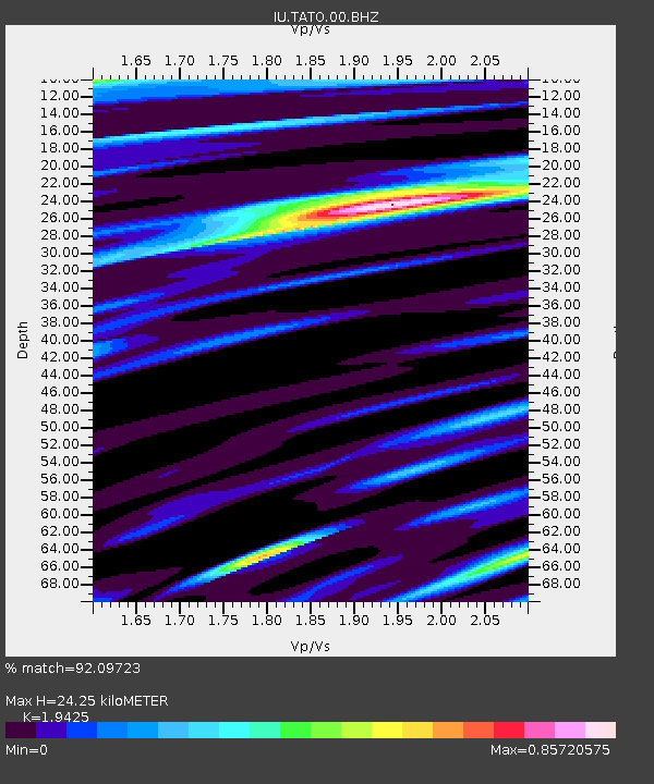
| Arrivals | |
| Ps | 3.9 SECOND |
| PpPs | 11 SECOND |
| PsPs/PpSs | 15 SECOND |

