You are here: Home > Network List > II - Global Seismograph Network (GSN - IRIS/IDA) Stations List
> Station MSEY Mahe, Seychelles > Earthquake Result Viewer
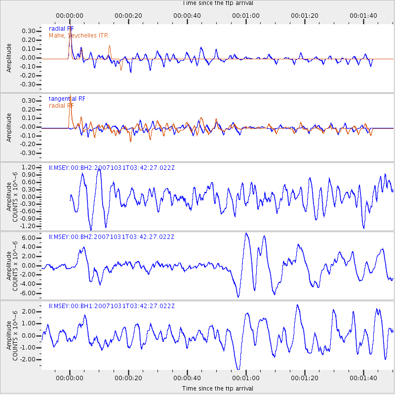
MSEY Mahe, Seychelles - Earthquake Result Viewer

| Earthquake location: |
Mariana Islands |
| Earthquake latitude/longitude: |
18.9/145.4 |
| Earthquake time(UTC): |
2007/10/31 (304) 03:30:17 GMT |
| Earthquake Depth: |
223 km |
| Earthquake Magnitude: |
6.2 MB, 7.2 MW, 7.2 MW |
| Earthquake Catalog/Contributor: |
WHDF/NEIC |
|
| Network: |
II Global Seismograph Network (GSN - IRIS/IDA) |
| Station: |
MSEY Mahe, Seychelles |
| Lat/Lon: |
4.67 S/55.48 E |
| Elevation: |
475 m |
|
| Distance: |
91.4 deg |
| Az: |
265.566 deg |
| Baz: |
71.27 deg |
| Ray Param: |
0.041512758 |
| Estimated Moho Depth: |
30.0 km |
| Estimated Crust Vp/Vs: |
1.76 |
| Assumed Crust Vp: |
6.303 km/s |
| Estimated Crust Vs: |
3.576 km/s |
| Estimated Crust Poisson's Ratio: |
0.26 |
|
| Radial Match: |
87.89254 % |
| Radial Bump: |
400 |
| Transverse Match: |
73.29736 % |
| Transverse Bump: |
400 |
| SOD ConfigId: |
590571 |
| Insert Time: |
2013-09-26 16:08:04.534 +0000 |
| GWidth: |
2.5 |
| Max Bumps: |
400 |
| Tol: |
0.001 |
|
Signal To Noise
| Channel | StoN | STA | LTA |
| II:MSEY:00:BHZ:20071031T03:42:27.022Z | 4.517618 | 2.0789548E-6 | 4.6018826E-7 |
| II:MSEY:00:BH1:20071031T03:42:27.022Z | 1.7375101 | 6.6832325E-7 | 3.8464424E-7 |
| II:MSEY:00:BH2:20071031T03:42:27.022Z | 0.53855735 | 3.0733122E-7 | 5.706564E-7 |
| Arrivals |
| Ps | 3.7 SECOND |
| PpPs | 13 SECOND |
| PsPs/PpSs | 17 SECOND |


