You are here: Home > Network List > IU - Global Seismograph Network (GSN - IRIS/USGS) Stations List
> Station RSSD Black Hills, South Dakota, USA > Earthquake Result Viewer
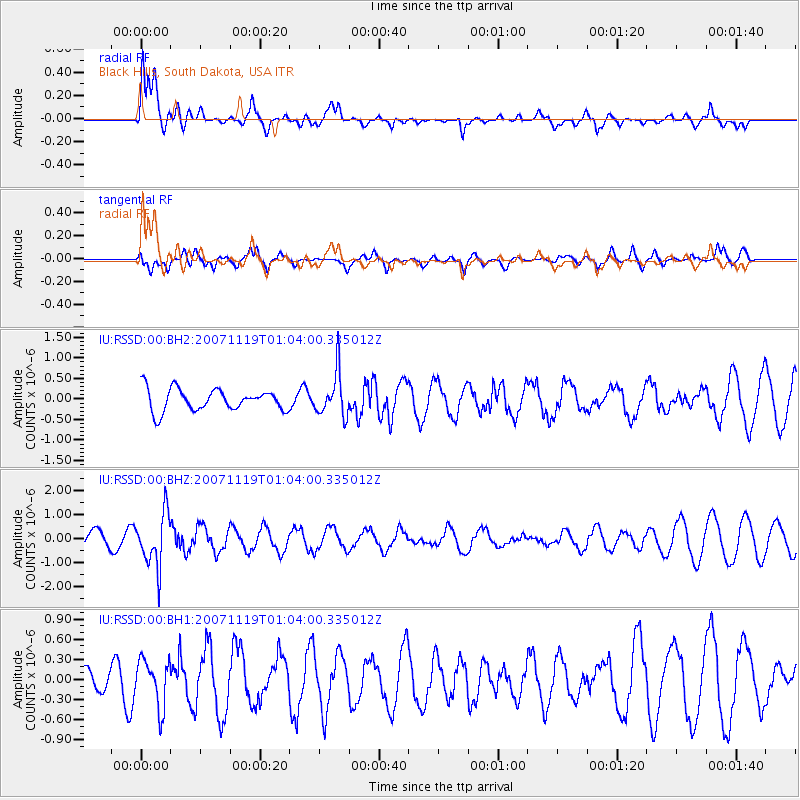
RSSD Black Hills, South Dakota, USA - Earthquake Result Viewer
*The percent match for this event was below the threshold and hence no stack was calculated.
| Earthquake location: |
Fiji Islands Region |
| Earthquake latitude/longitude: |
-21.2/-178.8 |
| Earthquake time(UTC): |
2007/11/19 (323) 00:52:12 GMT |
| Earthquake Depth: |
558 km |
| Earthquake Magnitude: |
6.2 MB, 6.3 MW, 6.3 MW |
| Earthquake Catalog/Contributor: |
WHDF/NEIC |
|
| Network: |
IU Global Seismograph Network (GSN - IRIS/USGS) |
| Station: |
RSSD Black Hills, South Dakota, USA |
| Lat/Lon: |
44.12 N/104.04 W |
| Elevation: |
2060 m |
|
| Distance: |
94.1 deg |
| Az: |
44.151 deg |
| Baz: |
244.498 deg |
| Ray Param: |
$rayparam |
*The percent match for this event was below the threshold and hence was not used in the summary stack. |
|
| Radial Match: |
66.61429 % |
| Radial Bump: |
400 |
| Transverse Match: |
46.303234 % |
| Transverse Bump: |
400 |
| SOD ConfigId: |
590571 |
| Insert Time: |
2013-09-26 16:46:34.270 +0000 |
| GWidth: |
2.5 |
| Max Bumps: |
400 |
| Tol: |
0.001 |
|
Signal To Noise
| Channel | StoN | STA | LTA |
| IU:RSSD:00:BHZ:20071119T01:04:00.335012Z | 2.3897595 | 1.1129104E-6 | 4.6569969E-7 |
| IU:RSSD:00:BH1:20071119T01:04:00.335012Z | 0.9185777 | 3.5280254E-7 | 3.840748E-7 |
| IU:RSSD:00:BH2:20071119T01:04:00.335012Z | 1.9921693 | 5.294966E-7 | 2.6578897E-7 |
| Arrivals |
| Ps | |
| PpPs | |
| PsPs/PpSs | |


