You are here: Home > Network List > IU - Global Seismograph Network (GSN - IRIS/USGS) Stations List
> Station RSSD Black Hills, South Dakota, USA > Earthquake Result Viewer
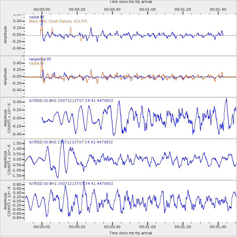
RSSD Black Hills, South Dakota, USA - Earthquake Result Viewer
*The percent match for this event was below the threshold and hence no stack was calculated.
| Earthquake location: |
Near Coast Of Northern Chile |
| Earthquake latitude/longitude: |
-23.2/-70.5 |
| Earthquake time(UTC): |
2007/12/13 (347) 07:23:39 GMT |
| Earthquake Depth: |
16 km |
| Earthquake Magnitude: |
6.2 MW, 5.5 MB, 5.9 MS, 6.1 MW |
| Earthquake Catalog/Contributor: |
NEIC PDE/NEIC PDE-M |
|
| Network: |
IU Global Seismograph Network (GSN - IRIS/USGS) |
| Station: |
RSSD Black Hills, South Dakota, USA |
| Lat/Lon: |
44.12 N/104.04 W |
| Elevation: |
2060 m |
|
| Distance: |
73.7 deg |
| Az: |
335.541 deg |
| Baz: |
148.066 deg |
| Ray Param: |
$rayparam |
*The percent match for this event was below the threshold and hence was not used in the summary stack. |
|
| Radial Match: |
74.97952 % |
| Radial Bump: |
400 |
| Transverse Match: |
69.96108 % |
| Transverse Bump: |
400 |
| SOD ConfigId: |
590571 |
| Insert Time: |
2013-09-26 17:40:18.133 +0000 |
| GWidth: |
2.5 |
| Max Bumps: |
400 |
| Tol: |
0.001 |
|
Signal To Noise
| Channel | StoN | STA | LTA |
| IU:RSSD:00:BHZ:20071213T07:34:41.447983Z | 2.1328769 | 5.482485E-7 | 2.5704648E-7 |
| IU:RSSD:00:BH1:20071213T07:34:41.447983Z | 2.0020676 | 3.4548216E-7 | 1.725627E-7 |
| IU:RSSD:00:BH2:20071213T07:34:41.447983Z | 0.8329483 | 1.212513E-7 | 1.4556883E-7 |
| Arrivals |
| Ps | |
| PpPs | |
| PsPs/PpSs | |


